Reclamation is involved with a number of river restoration efforts throughout the Western United States, including the San Joaquin and Trinity in California, the Grande Rhonde in Oregon, the Lemhi and Yankee Fork in Idaho, the Elwha in Washington, and the Colorado along the California/Arizona border. Although the specific goals of the restoration activities vary from river to river, they usually include provisions to improve riverine habitat for native fish populations that have been adversely affected by human activity (for example, reduced flows due to agricultural development, altered temperature and sediment load regimes and blocked migration routes resulting from dam construction). Remediation activities might include river channel modification, addition or removal of floodplain vegetation, and where possible, modification of river flow regimes. Most of these projects make use of lidar and multispectral image data to characterize pre-treatment vegetation and terrain conditions, to aid in the development of site improvement plans, and to monitor restoration activities.
The San Joaquin River Restoration Program is a comprehensive long-term effort to restore flows to approximately 92 miles of the San Joaquin River in California’s Central Valley from Friant Dam to the confluence of the Merced River. Its goal is to restore and maintain fish populations in “good condition”, including naturally reproducing and self-sustaining populations of salmon and other fish, while reducing or avoiding adverse water supply impacts to irrigators. This effort will include a combination of channel and structural modifications along the River, and reintroduction of Chinook Salmon.
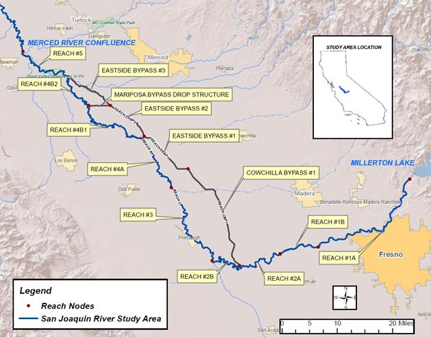 San Joaquin River Restoration Program Area extends 92 miles from Friant Dam (impounding Millerton Lake) to the confluence of the San Joaquin and Merced Rivers.
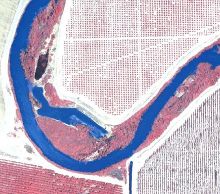
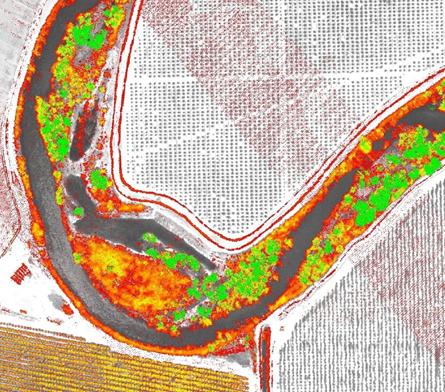
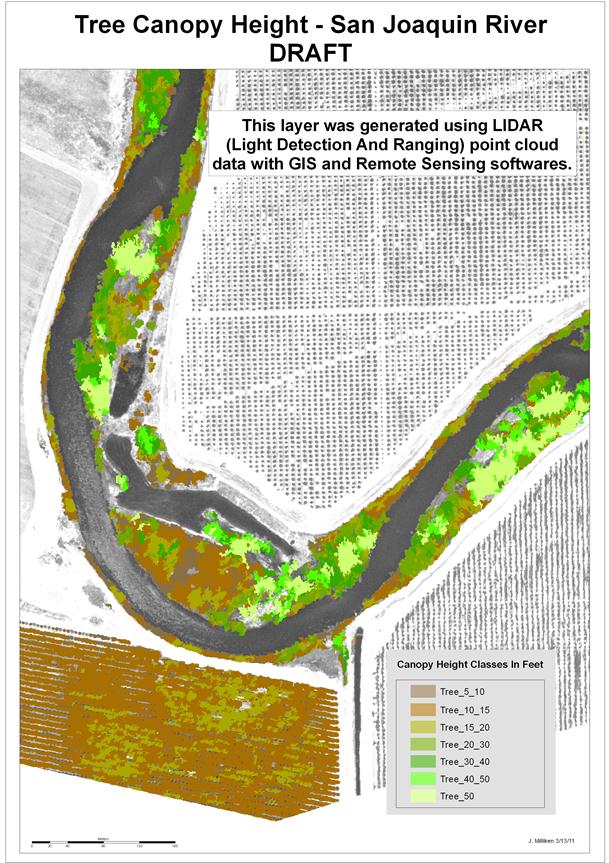
Five different interim flows released from Friant Dam in 2011 allowed for the collection of relevant data concerning fish habitat such as wetted area, water temperature, flow velocities, and riparian vegetation. Two-foot resolution aerial color infrared (CIR) imagery were acquired during each interim flow to map inundated area and riparian vegetation. Both terrestrial and water-penetrating airborne lidar were also acquired to map both the top of the vegetation canopy, as well as “bare-earth” floodplain and river channel topography. “Last-return” LiDAR points were used to produce bare-earth digital elevation models used in hydraulic models to predict river flow velocities, depths, and inundated areas at specified river discharges. Elevation models generated from lidar “first returns” characterized the top of the vegetation canopy. Subtracting the “bare earth” grid from the “vegetation canopy” grid produced a raster data set of vegetation height. Maximum vegetation height values from this data set were used to create tree height classes for an object-based image classification of the aerial imagery . Tree heights aid in the differentiation of tree and non-tree vegetation, allow for hybrid classification of tree type, and aid near-bank fish habitat modeling. For more information on the San Joaquin River Restoration Project, please go to: http://www.restoresjr.net.
Open water surface layer (transparent blue) shown over CIR aerial imagery of the San Joaquin River, CA.
Vegetation height (red = 5 feet, green = 50 feet or more) derived from lidar data, San Joaquin River, CA.
Image objects with assigned vegetation height classes (low = brown, tall = green), San Joaquin River, CA.
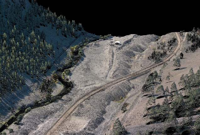
Reclamation has partnered with State and local organizations in the Salmon River Basin to restore salmon habitat in tributaries to the Salmon River. As a part of this effort, Reclamation acquired lidar and 6-inch-resolution aerial multispectral imagery of the Yankee Fork River in central Idaho. The lidar data are of sufficient quality to classify important floodplain features such as sand and gravel bars, and disconnected river channels and provide estimates of surface roughness useful in hydraulic modeling. These data were used to model inundated areas at estimated 10-year and 100-year flood flows. The lidar and ortho imagery (generated from the lidar and multispectral image data) were also useful for identifying channelized portions of the river for potential remediation, and quantifying volumes of placer mining waste.
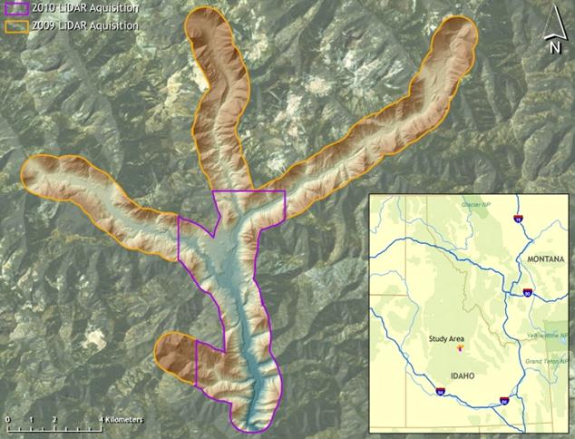 The Yankee Fork of the Salmon River in Central Idaho.
Lidar point cloud along the Yankee Fork River, Idaho showing channelization and spoil mounds resulting from placer gold mining in the 1940s and 1950s. Colors for lidar point locations are provided by orthoimagery acquired concurrently with the lidar.


