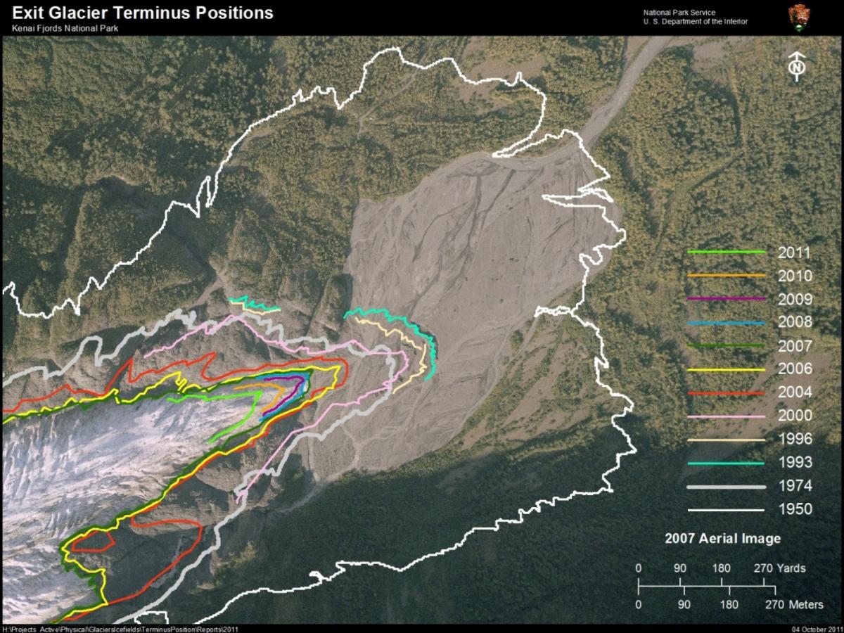
Kenai Fjords National Park staff use GPS technology to map the terminus of Exit Glacier at the beginning and end of each summer. This semiannual monitoring effort allows park managers to understand changes in the perimeter of the terminus both seasonally and annually. An aerial photo map was created to illustrate Exit Glacier's dramatic retreat in a manner that is readily understood by a wide audience.
NPS researcher using a GPS to map the terminus of Exit Glacier in Kenai Fjords National Park
Aerial photomap illustrating the dramatic retreat of Exit Glacier in Kenai Fjords National Park


