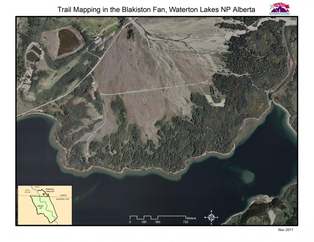
High resolution aerial photography along the international boundary, acquired in 2009 for use by the Department of Homeland Security, provided an excellent mapping base for restoration planning by Parks Canada. Submeter GPS data were used by Glacier’s International Peace Park neighbor, Waterton Lakes National Park in Alberta, Canada, to map and analyze concession horse trail impacts to a Canadian Species at Risk: the Halfmoon hairstreak butterfly (Satyrium semiluna). GPS data collected in the Blakiston Fan area were used to delineate critical habitat and then trail closure and restoration plans were developed with the goal of reducing habitat fragmentation.
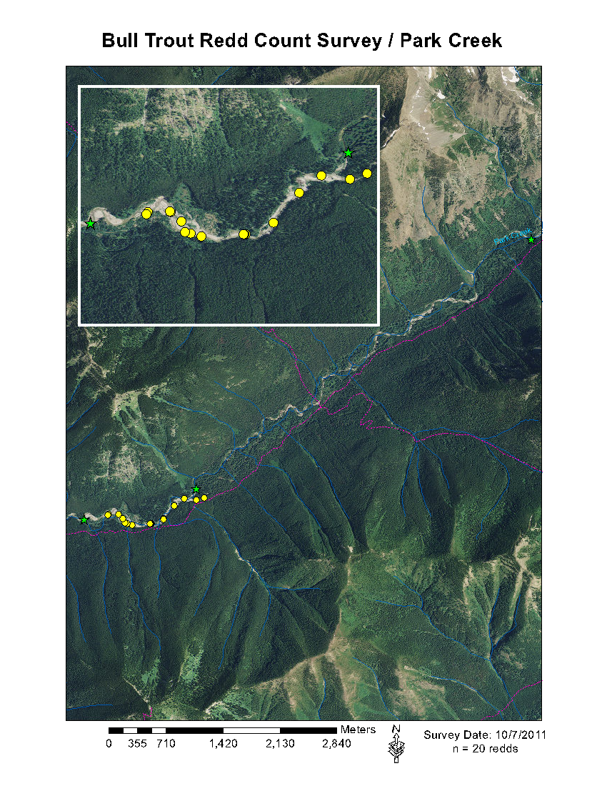
Bull trout (Salvelinus confluentus) is a threatened char species native to the Intermountain West. A combination of habitat degradation, fragmentation, and introductions of non-native species has led to the decline of bull trout populations across their native range and within the Glacier National Park ecosystem. Beginning in the early 1980s, annual surveys to document bull trout spawning activity, known as redd counts, provided valuable monitoring data for index streams in Glacier. This information was originally collected on paper maps but more recently, GPS and GIS are used to precisely document spawning sites and visualize those results on aerial photography. NAIP imagery provides a mapping base allowing fisheries biologists to assess the spatial variation in redd distributions over time as influenced by changes in stream morphology. More recently the focus of native fish conservation has extended north into British Columbia Canada, as research has documented the importance of headwater streams to both bull trout and westslope cutthroat trout. The North Fork of the Flathead River connects those headwater areas to waters west of the Continental Divide in Glacier, and the tributaries of the Flathead system are considered precarious habitats for regional native fish conservation efforts.
 Park staff continued the trend to institutionalize the application of GPS and GIS technologies towards important and diverse park management needs. Routine workflows that survey and monitor wildlife and vegetation, assist with Search and Rescue operations, and document historic features now depend on GPS data and subsequent visualization and analysis of those data using GIS and recent orthoimagery.
-
Glacier’s Integrated Pest Management (IPM) program documented exotic vegetation populations using GPS and monitored the effectiveness of treatments to these populations using GIS-based field maps and related descriptive notes.
-
The park’s first formal bat inventory in 2011 used a GIS analysis of vegetation/habitat and proximity to roads and trails, to determine sample locations. Sample sites were then documented using GPS.
- A harlequin duck research project fitted female ducks with radio transmitters, yielding X/Y locations that were analyzed in GIS to assess habitat utilization. Harlequin Ducks are listed as a species of concern in Montana, where they are at high risk of extirpation due to their very limited numbers, limited habitat, disturbance, and habitat loss or alteration. One bird was documented in the Puget Sound, hundreds of miles from their breeding grounds in Glacier.
- Ranger staff responded to two Search and Rescue events in 2011 assisted by GIS mapping products that show GPS track log paths of previous ground and air-based search parties.
- Sub-meter GPS was used to document new cultural features and conduct condition assessments of existing cultural resource sites, greatly improving the spatial resolution of feature mapping at those sites. Notable was the 2011 discovery and documentation of an abandoned adit from the brief heyday of copper mining in Glacier, ca. 1896.
Recently acquired NAIP and Border Area orthoimagery are valuable backdrops for revisions to core geospatial base map data sets in the Glacier National Park. The 2009 Montana NAIP data were used to revise hydrology data for stream reaches in Glacier that experienced channel shifting due to spring runoff events. The revised data will assist the Montana State Library’s coordinated edits to the National Hydrologic Dataset (NHD). More importantly, approximately forty percent of the park boundary is defined by stream channel location and revisions to those stream segments resulted in a current, or “working”, park boundary theme in GIS. The NAIP-derived working boundary layer was used in 2011 to define a project area boundary for the park’s NRCS soil inventory. NAIP and Border Area data also helped update park trails and building footprints in remote settings where ground-based GPS mapping efforts come at a great expense.


