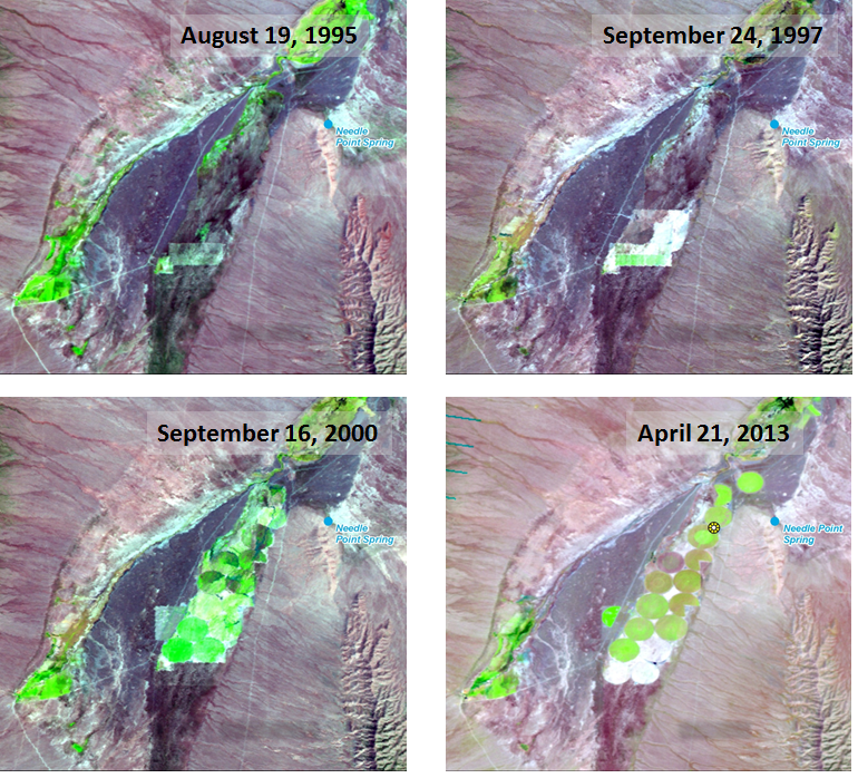
The Bureau of Land Management (BLM) is studying the impacts of agriculture development on water resources in a remote region along the Nevada/Utah border. BLM utilized historical Landsat imagery to build a chronology of land use changes in the region. Given a rich archive of scenes dating back decades, Landsat is the only data source of its kind with the required spatial and temporal detail to enable BLM to build such a database. BLM evaluated 76 Landsat scenes dating back to 1995 in order to build a detailed image-based chronology of center pivot agricultural field establishment.
Landsat time series depicting the installation of center pivot agricultural fields over time in the Needle Point Spring, Utah area. The imagery are displayed as false color composites using a 5, 4, 3 band combination. Live vegetation appears as green. Circular patterns indicate center pivot irrigation.


