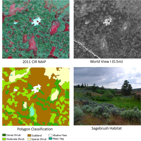
Sage and sharp-tailed grouse were both reintroduced into the scabland area of eastern Washington. BLM is part of an interagency effort to monitor their breeding success and habitat selection. Current 30-m vegetation maps are too coarse for habitat analysis. Field data used in the classification were collected at bird nesting sites and along randomly placed transects. Color infrared 2011 National Agriculture Imagery Program (NAIP) (1-m) and panchromatic WorldView-1 (0.5-m) imagery were used to develop a habitat map. Mapped classes include three densities of sagebrush, scabland, trees, wetland, agriculture and water. Results of the habitat analysis will help determine appropriate habitat management plans for the future success of both species.
Input imagery and final polygon habitat map for sage and sharp-tailed grouse.


