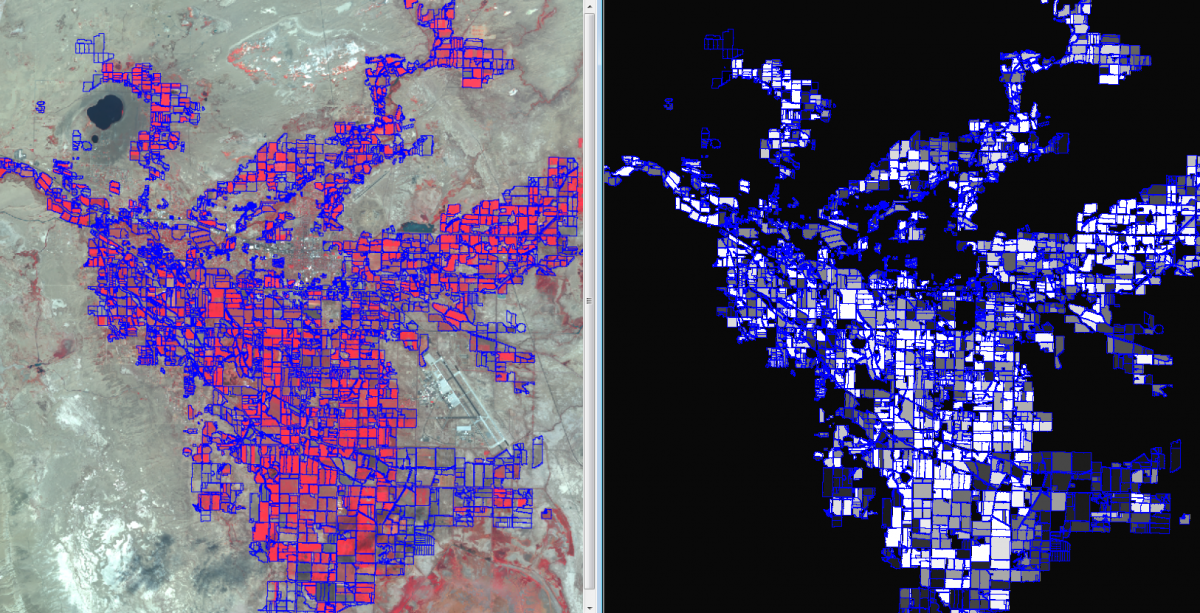
Reclamation is responsible for administration of the Operating Criteria and Procedures (OCAP) for the Newlands Reclamation Project in Nevada. The OCAP directs Reclamation and the Truckee-Carson Irrigation District to identify and report "the number of acres of eligible land irrigated in the Project" as well as "possible irrigation of ineligible land" and "eligible land that was not irrigated." To help determine the irrigation status, Reclamation uses Satellite Pour l'Observation de la Terre (SPOT) data to determine the mean vegetation index of each agricultural field four times per year.
Left: SPOT satellite imagery with agricultural field borders. Right: grayscale image of mean Normalized Difference Vegetation Index (NDVI) with field borders (white = highly vegetated).
http://www.usbr.gov/projects/Project.jsp?proj_Name=Newlands%20Project


