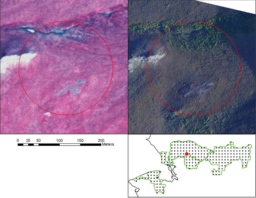
The National Park Service (NPS) Arctic Inventory and Monitoring Network (ARCN) is concerned with understanding widespread ecological changes in the northern Alaskan national parks. Repeat photography is used to document changes in vegetation, water bodies, and certain landforms. The present study compares recent (2008-2010) high-resolution aerial photographs with historical aerial photographs to document changes that have occurred in ARCN over the past 30 years (see figure showing tall shrub increase on tundra). High-resolution aerial photography will be taken at 10- to 20-year intervals and analysis will be repeated to detect changes.
Tall shrub increase on tundra. Left image shows mostly herbaceous and low shrub vegetation in 1979 (Alaska High Altitude Aerial Photography (AHAP) Program color infrared photo). On right, this area was colonized by tall shrubs by 2008 (small-format true color photo). The grayish area along the creek on the 1979 photo is probably a snow bed - note the small residual patch of snow (on 12 July) along the creek on the upper left just outside the plot (circled area). The red dot on the inset map shows the location of the plot in the Noatak National Preserve, Alaska. See http://science.nature.nps.gov/im/units/arcn/ for more information.


