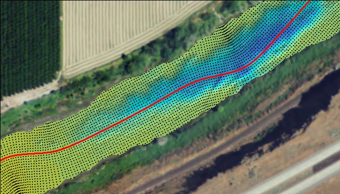
The Bureau of Reclamation’s (Reclamation) Sedimentation and River Hydraulics Group uses light detection and ranging (lidar) data in conjunction with river and reservoir bathymetric surveys to develop continuous topographic/bathymetric surfaces. These surfaces are used to provide the elevation values for cross sections or structured/irregular mesh elements that are in turn used as inputs to one-, two-, and three-dimensional hydraulic modeling. Hydraulic models use these data and user-specified flow rates to produce maps of wetted area, water surface profiles, and three-dimensional velocity estimates. Results are used to analyze flood risk and to estimate patterns and rates of sedimentation in canals, rivers, and reservoirs.
http://www.usbr.gov/pmts/sediment/

Example of a continuous topographic surface developed from interpolated bathymetric survey data and terrestrial lidar along the San Joaquin River in California. (Background imagery source: 2012 National Agriculture Imagery Program at approximately 1:2,000 scale.)

