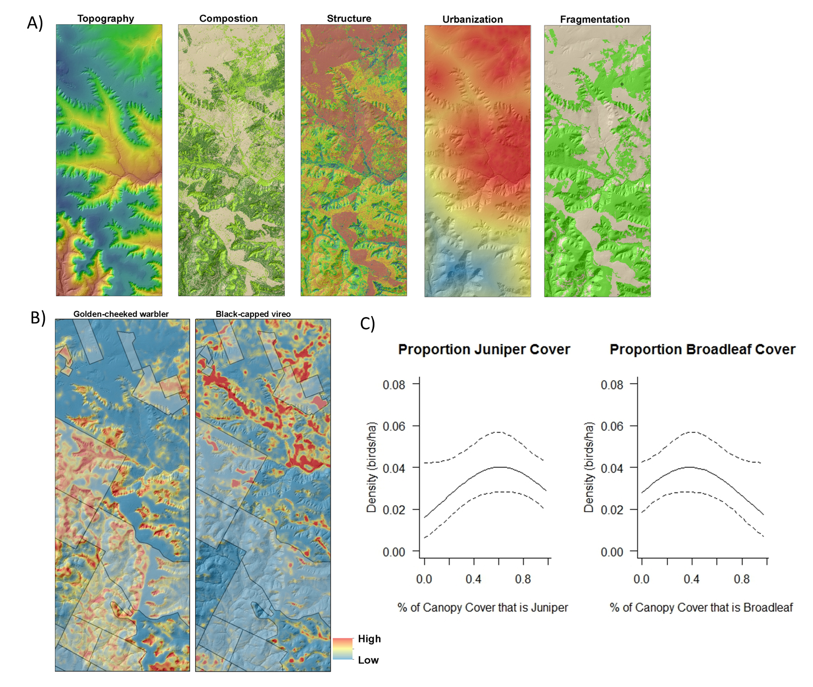
The golden-cheeked warbler and black-capped vireo were listed by the USFWS as endangered in 1990 and 1987, respectively. In 1992 the 10,000-ha Balcones Canyonlands National Wildlife Refuge (BCNWR) was established in Texas to protect habitat for these two species. The warbler occupies later successional stages of oak and Ashe juniper woodland habitat during the breeding season, and the vireo prefers early successional shrublands. Contemporary habitat models for songbirds often lack fine-scale habitat information mapped over large areas. Lidar data and high spatial resolution National Agriculture Imagery Program color infrared (NAIP-CIR) aerial photography were used to characterize habitat structure and composition over the entire refuge. Habitat features such as successional stages, conifer and broadleaf tree canopy cover, tree density, and vertical and horizontal structural complexity were derived using machine learning and other statistical methods. These data layers were used as model covariates to develop empirical estimates of warbler and vireo population density and occupancy rates on and off refuge lands. Spatial model outputs are being used to prioritize conservation and habitat restoration activities that are part of endangered species and habitat recovery efforts.
http://www.fws.gov/refuges/refugeupdate/pdfs/2014/refUp_JanFeb_2014.pdf

A) Classes of spatially explicit songbird habitat model covariates developed using lidar and NAIP-CIR aerial photography, B) Golden-cheeked warbler and black-capped vireo habitat model predictions on and off refuge lands (shaded areas), and C) Predicted golden-cheeked warbler density relationships with remote sensing derived habitat characteristics.

