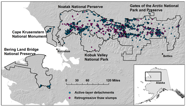
NPS used high-resolution IKONOS satellite images and a combination of manual and computer-assisted methods to map slumps and small landslides caused by thaw of permafrost in Alaska's Arctic national parks. These five NPS units cover over 8 million ha, about a quarter of all the NPS-managed land in the USA. We found over 2,000 active-layer detachments (ALD) and over 700 retrogressive thaw slumps (RTS). Re-mapping at 5- to 10-year intervals is planned to determine trends in the number, area, and distribution of these features.
http://science.nature.nps.gov/im/units/arcn/vitalsign.cfm?vsid=9

Map showing slumps and small landslides from permafrost thaw in northern Alaska's national parks.

