BLM has partnered with the U.S. Geological Survey (USGS) and Multi-Resolution Land Characteristics Consortium (MRLC) in a multi-year mapping and monitoring program to better characterize shrubland and grassland ecosystems in the western United States. For several management objectives in semi-arid to arid ecosystems, the BLM requires more detailed information about land cover and vegetation than is currently offered in existing national products (e.g., National Land Cover Database (NLCD), Landscape Fire and Resource Management Planning Tools Project (LANDFIRE)).
To address this need, the BLM began collaborating in 2013 with the USGS and MRLC to create remote sensing-based products of western shrublands and grasslands at 2-m and 30-m spatial resolutions that quantify per-pixel estimates of several main shrubland components, including total shrubs, sagebrush, herbaceous cover, annual vegetation cover, litter, bare ground, and shrub height. Although mapping the entire western U.S. with these methods will take approximately 5 years to complete, the project will provide valuable baseline data and the ability to monitor the landscape components long-term. This project is a key part of BLM’s landscape monitoring strategy and integral to our efforts within the sage-grouse initiative (see discussion below: Remote-sensing-based Indicator for Mid-Scale Monitoring of Sagebrush Habitat).
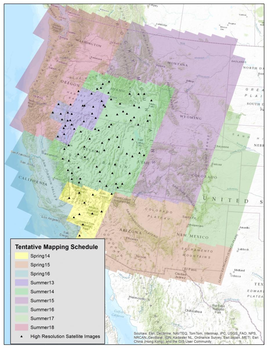
Initial products were developed in 2013 for southwestern Idaho, southeastern Oregon, northwestern Nevada, and northeastern California. The initial effort was used to develop and refine operational procedures for mapping in subsequent years. The 2014 products include the Mojave Desert, the Great Basin, western Utah, and southern Idaho, which cover significant portions of greater sage-grouse and desert tortoise habitats. The products derived from this mapping effort will be integrated into the NLCD for future updates and used to improve characterization of grassland and shrubland ecological systems within the LANDFIRE program.

Tentative schedule for the grassland/shrubland mapping effort.

