In 2009, a remarkable new dinosaur tracksite was discovered on lands administered by the Moab Field Office, containing one of the largest multitaxic tracksites in North America. The Mill Canyon Dinosaur Tracksite preserves 10 different types of tracks, including various dinosaurs, birds, and crocodiles, with over 200 tracks being documented in an area of approximately 500 m2. The site is being studied by an international team, lead by Dr. Martin Lockley of the University of Colorado at Denver. The tracks are preserved in the 112-million-year-old Lower Cretaceous Ruby Ranch Member of the Cedar Mountain Formation.
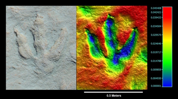
Starting in 2013, BLM National Operations Center (NOC) and Wyoming State Office worked to thoroughly document the site with stereo photography. Digital images were processed using photogrammetric software to render high-resolution, 3D images of the surface and associated tracks. This imagery will be used by the BLM for documentation, research, monitoring, and management purposes.

Photogrammetric image of a large theropod track from the Mill Canyon Tracksite (left). Distortions from camera lens have been removed from this image, making possible precise direct measurements of length and width. A photogrammetrically derived 3D digital point cloud models the surface with submillimeter resolution (right). The digital surface is color-coded to represent depth with dark blue being the deepest. This track is just over 3 cm deep at the deepest point.

