On the San Carlos Apache Reservation in east-central Arizona, fire suppression and other factors have led to overstocked forests and woodland encroachment into grasslands. In an effort to retain traditional relationships with the land, the San Carlos Apache Tribe is working to restore the land to approximate pre-European settlement conditions using a combination of fire and mechanical thinning. An accurate forest biomass baseline is important for future carbon balance projections. Overall and species-specific aboveground biomass was estimated from active and passive remote sensing sources including high point density airborne lidar, and high and moderate spatial resolution WorldView-2 and Landsat 8 satellite data. Across all species, combined lidar-derived height and intensity metrics provided the most robust estimate for aboveground biomass, producing models with R2 values above 0.8 and root mean square error (RMSE) less than 14 Mg/ha. Species-specific aboveground biomass models based on Landsat 8 yielded errors ranging from 9 to 28 Mg/ha, whereas models based on WorldView-2 yielded errors of 17 to 44 Mg/ha. Structural information extracted from lidar provided accurate estimates for fine-scale aboveground biomass mapping, while spectral information derived from Landsat 8 can be used for large-scale biomass mapping. Long-term forest carbon records derived from active and passive remote sensing could be used to direct forest resource management efforts (e.g., thinning and burning) to avoid catastrophic fires, retain stored carbon, and maintain long-term carbon sink strength of forest ecosystems.

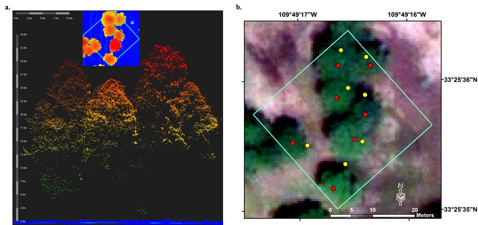
Individual tree characteristics extracted from lidar for mapping biomass: (a) Sample lidar data point cloud cross section of a ponderosa pine dominant area with plot overview (inset). Ground points are shown in blue, and vegetation points are shown in rainbow colors with red representing the tree tops. (b) Point cloud data extracted tree tops (red) and field collected Global Positioning System (GPS) points (yellow) at the crown edge, overlaid on the natural color WorldView-2 imagery acquired on July 29, 2013, showing a good spatial agreement between the lidar, WorldView-2 and GPS data.

