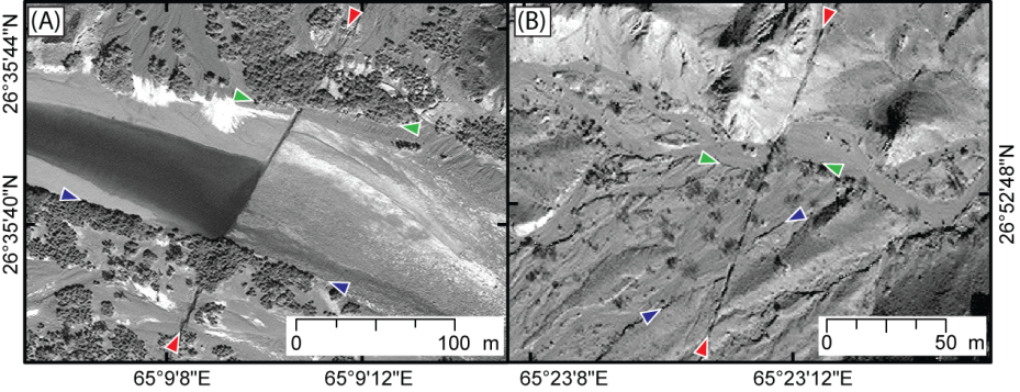
The Balochistan, Pakistan, earthquake (magnitude 7.7) ruptured an approximately 200-km-long stretch of the Hoshab Fault in southern Pakistan on September 24, 2013. To help understand the impact of such a large event, scientists at the the USGS Geologic Hazard Science Center (Golden, Colorado) mapped the resulting ground surface rupture using high-resolution (0.5 m) pre- and post-event satellite imagery accessed via Digital Globe’s Enhanced View WebHosting platform. Surface displacement resulting from the earthquake was measured by identifying laterally offset streams, river terrace edges, and roads. Peak left-lateral offsets of about 12–16 m are among the largest ever documented for strike-slip fault displacements. An initial manuscript describing the tectonic context for this earthquake was published in Earth and Planetary Science Letters (Barnhart et al., 2014) and the results were presented at the 2014 American Geophysical Union Fall Meeting.
http://www.sciencedirect.com/science/article/pii/S0012821X14004439

High-resolution optical imagery (©DigitalGlobe, NextView license) showing left-lateral surface rupture associated with the Balochistan earthquake. Red triangles depict fault trace, and blue and green triangles show left-laterally faulted stream margins and gullies.

