The USGS, working in partnership with the Federal interagency Multi-Resolution Land Characteristics (MRLC) Consortium, has completed the production of the National Land Cover Database (NLCD) 2011 for the conterminous United States. The NLCD serves as the definitive Landsat-based, 30-meter pixel resolution, land cover database for the Nation. NLCD 2011 products derived from nominal 2011 Landsat data depict 16 classes of land cover, define the degree of surface imperviousness in urban areas, and quantify the amount of tree canopy cover.
NLCD 2011 innovations include integration with previous NLCD versions to provide a 10-year land cover change story for the Nation at 5-year intervals, a quicker production time over previous efforts, more comprehensive change and image analysis methods resulting in more accurate products, a more comprehensive update of the imperviousness product resulting in more accurate products for each era in the last 10 years, and the first-ever change analysis of Alaska. In early 2015, NLCD 2011 was released for Alaska, quantifying land cover change within the State between 2001 and 2011. Overall, NLCD remains a substantially evolving and important database to a wide range of users, making it essential to thousands of applications. It is used to inform a variety of investigations, from monitoring forests to modeling water runoff in urban areas. For more information on NLCD and to obtain NLCD data visit http://www.mrlc.gov/

NLCD 2011
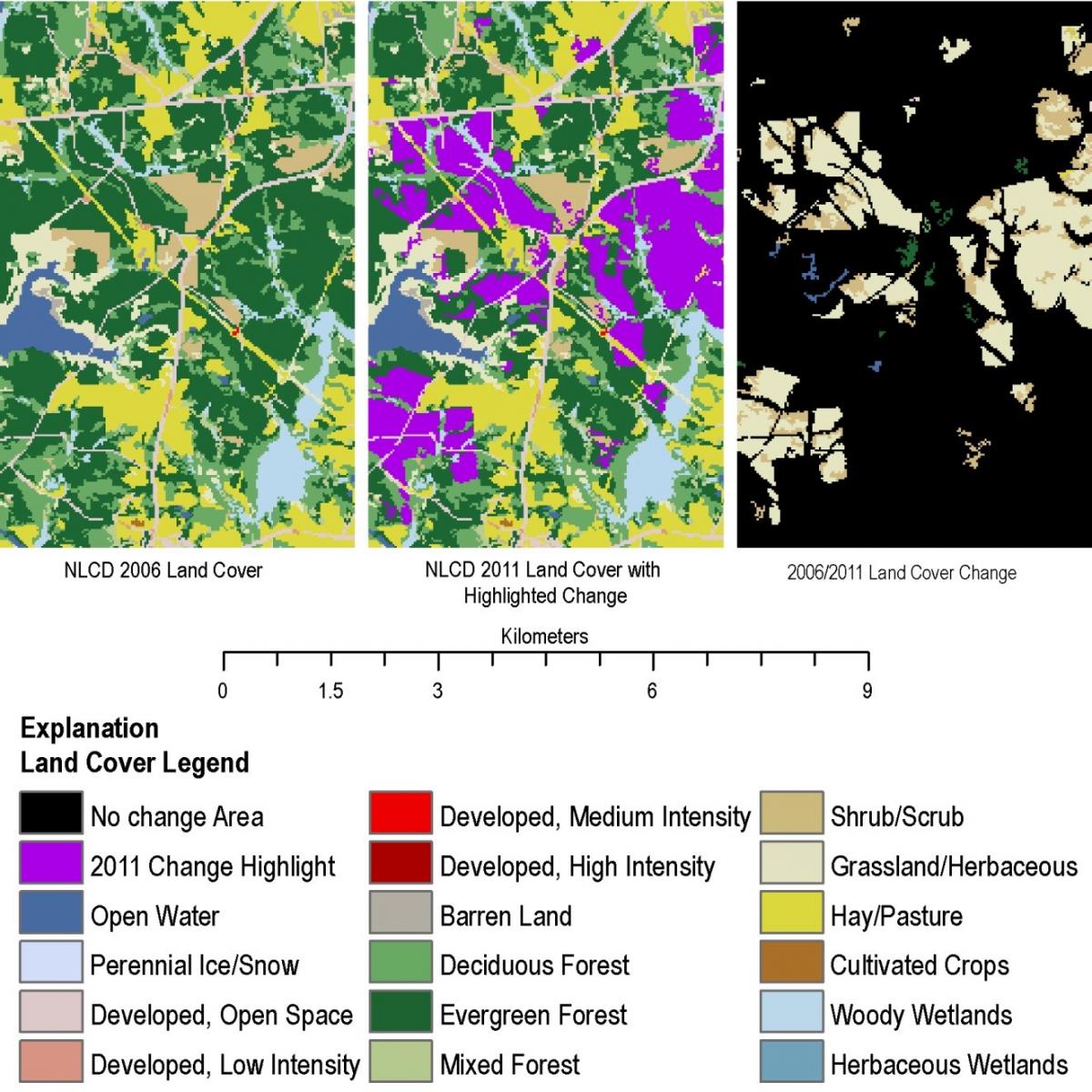
An example of land cover change in Pike County, Georgia (Landsat Path 19, Row 37). The change areas between 2006-2011 are highlighted in the middle panel above in purple. In this example, the change is coniferous forest from 2006 that has been converted to grass or shrub in 2011 – a typical land cover change that results from forest harvesting.

