The Bureau of Land Management National Operations Center (NOC) is leading efforts to collect very large scale aerial (VLSA) imagery in support of the agency’s natural resource programs. Using innovative techniques developed by the BLM photogrammetric division at the NOC, the BLM is collecting high-resolution remote sensing data with unmanned aerial systems (UAS).
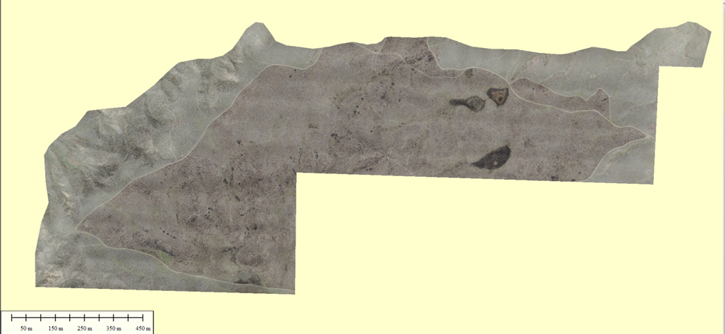
In April 2015, the NOC partnered with the BLM HiLine District Office in Montana to collect imagery over the Henry Smith archaeological site near the small town of Malta. The Henry Smith and Beaucoup sites are located in the Big Bend of the Milk Cultural Area of Critical Environmental Concern (ACEC), which encompasses nearly 2,000 acres in north-central Montana. Both sites are dominated by the presence of an Avonlea-period cultural resource complex, including a buffalo kill site, prehistoric drive lines, ground figures (both anthropomorphic and zoomorphic), habitation sites, and medicine wheels. The project also included a first-of-its-kind prescribed burn over a known cultural site to remove vegetation so that a more thorough and accurate aerial mapping mission could be accomplished. Products derived from this project include digital surface models and orthophotography.

Orthophoto mosaic derived from UAS-collected imagery, Henry Smith archaeological site. North is oriented toward the top of the image.

