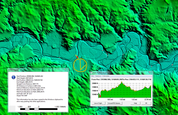
The Great Plains Reclamation Dakotas Area Office (DKAO) used remote sensing imagery in a Geographic Information Systems (GIS) environment to calculate pump requirements for an irrigation system. Interferometric Synthetic Aperture Radar (IFSAR) point cloud data were used to generate an elevation surface with better than 2-m root mean square error. After an ArcGIS shapefile of irrigation fields was added to the map, the Path/Profile tool in the Global Mapper software package was used to show the elevation profile of a new center-pivot irrigation system. The profile shows elevation details along the path designated by the yellow line, which crosses the river at a pump location (i.e., the minimum profile elevation, shown as a red dot on the map) and continues around and across the field to capture the highest elevations. Engineers use the elevation range to determine the power requirements necessary to lift water into all areas of the irrigated field. In the past, this process would have required a time- and labor-intensive field survey.

Elevation profile for a new center-pivot irrigation field.

