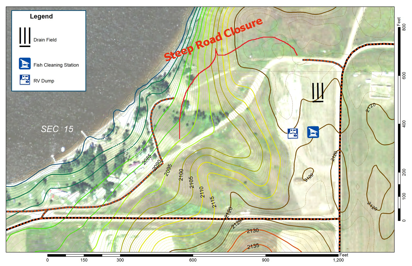
Interferometric Synthetic Aperture Radar (IFSAR) point cloud data were used to create a new contour map to assist with a facilities engineering project near a recreation area. Previous topographic sources provided insufficient detail: a 1979 topographic-contour map had 20-foot (6.1-m) contour intervals, and the derived digital elevation model (DEM) product would produce only 10-m accuracy. The new 1-foot (0.3-m) contour map created from the IFSAR product was used to locate the most level area to construct an recreational vehicle (RV) turnaround and cleaning station that could handle six RVs at one time, with an access road that was at least 150 feet (45.7 m) from a county road corner for safety. The map was also used to determine the area where a BOR gravel road was too steep for maintenance and durability.

The map uses an IFSAR-created contour map of 1-foot (0.3-m) intervals and a 2014 National Agricultural Image Program orthoimage base for planning purposes. North is oriented toward the top of the image.

