Semidesert grasslands in the arid Southwest have been substantially altered since the late 1800s by heavy livestock grazing, prolonged drought, and disrupted fire regimes. Prescribed fire plays a vital role in restoring the grassland vegetation and fuel bed conditions that were once maintained by frequent fire regimes. However, current fire management activities implemented at local to landscape scales must be compatible with the specific habitat requirements of threatened and endangered gallinaceous birds. Resource managers at the Buenos Aires National Wildlife Refuge (BANWR) in southern Arizona juggle these dual environmental imperatives. BANWR was established in 1985 to provide habitat for threatened and endangered plant and animal species, with an emphasis on the critically endangered masked bobwhite quail (Colinus virginianus ridgwayi). The presence of masked bobwhite is associated with productive semidesert grassland sites of moderate elevation (240–760 m), abundant grass cover and seed-producing plants, a high diversity of forbs, and interspersed woody plant cover.
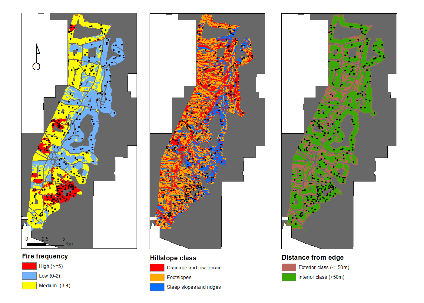
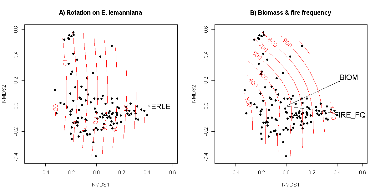
FWS Southwest Fire Management and Inventory and Monitoring (I&M) Programs have sought to map fire perimeters ≥ 4 ha in size using Landsat time series imagery and pre- and post-fire normalized burned area ratio (NBR) to enhance vegetation and habitat monitoring efforts on southwestern refuge lands. FWS scientists used BANWR fire perimeters to develop fire frequency strata for sampling vegetation in areas with a frequency of low (0–2 fires), medium (3–4 fires), and high (≥ 5 fires) over the last three decades. Data layers comprising three hillslope categories and 50-m-buffered roads were also used to locate vegetation plots within the BANWR masked bobwhite management zone. Most fires within the zone were prescribed burns conducted between 1985 and 2014. Multivariate analyses indicate that semidesert vegetation composition on plots (n = 116 plots) is significantly different (A = 0.04, p-value 0.001) among all three fire frequency strata. Areas with high fire frequency were strongly correlated with high fine-fuel biomass dominated by Lehmann lovegrass (Eragrostis lehmanniana), an invasive perennial bunch grass introduced from South Africa in the 1930s. Areas of low to moderate fire frequency may favor a greater abundance of native plants or lack site conditions suitable for E. lehmanniana. Further analyses are aimed at determining soil conditions and fire management activities most conducive to developing habitat preferred by the masked bobwhite on BANWR.

A stratified random sampling design was used to collect vegetation data on plots (black dots) within A) fire frequency and B) hillslope strata on BANWR (grey area) within the masked bobwhite management zone (colored areas). An additional C) distance from edge of a fire frequency class was used to assure that plots were located at least 50 m within fire strata to accommodate a 20 m x 50 m plot size.

Non-metric multidimensional scaling (NMDS) of vegetation plots and species cover showing A) plots dominated by E. lehmanniana (ERLE) and B) the direction of increased biomass (BIOM) and fire frequency (FIRE_FQ) on plots. Biomass is slightly pointed upwards along NMDS axis 2 toward plots located in low lying areas and relatively moist soils dominated by Amarathus palmeri. Red lines are fitted surface values for A) E. lehmanniana percent cover and B) herbaceous biomass (kg-1 ha).

