In September 2014, Grand Teton National Park and John D. Rockefeller Jr. Memorial Parkway partnered with the Fish and Wildlife Service (FWS) National Elk Refuge to collect high-resolution light detection and ranging (lidar) elevation data. The cooperative project with the National Elk Refuge, which shares a boundary with the parks, was jointly planned to support a variety of critical applications. As soon as the data became available, NPS geographic information system (GIS), hydrology, and project management staff were able to use the elevation data in a number of diverse projects.
Selected projects using these data include the following.
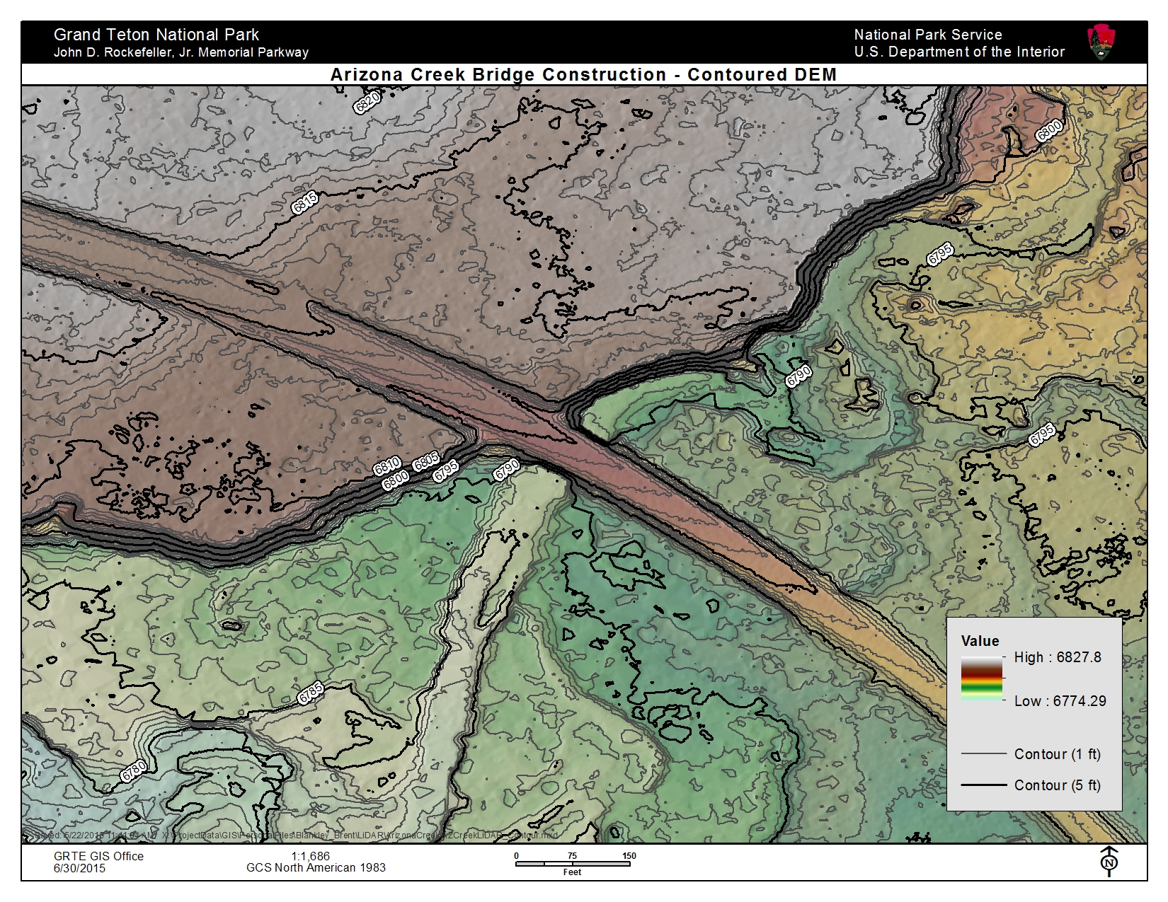
- The park conducted topographic surface and contour analysis for several park construction projects, eliminating the need for contract surveys in several cases, which saved the NPS time and money.
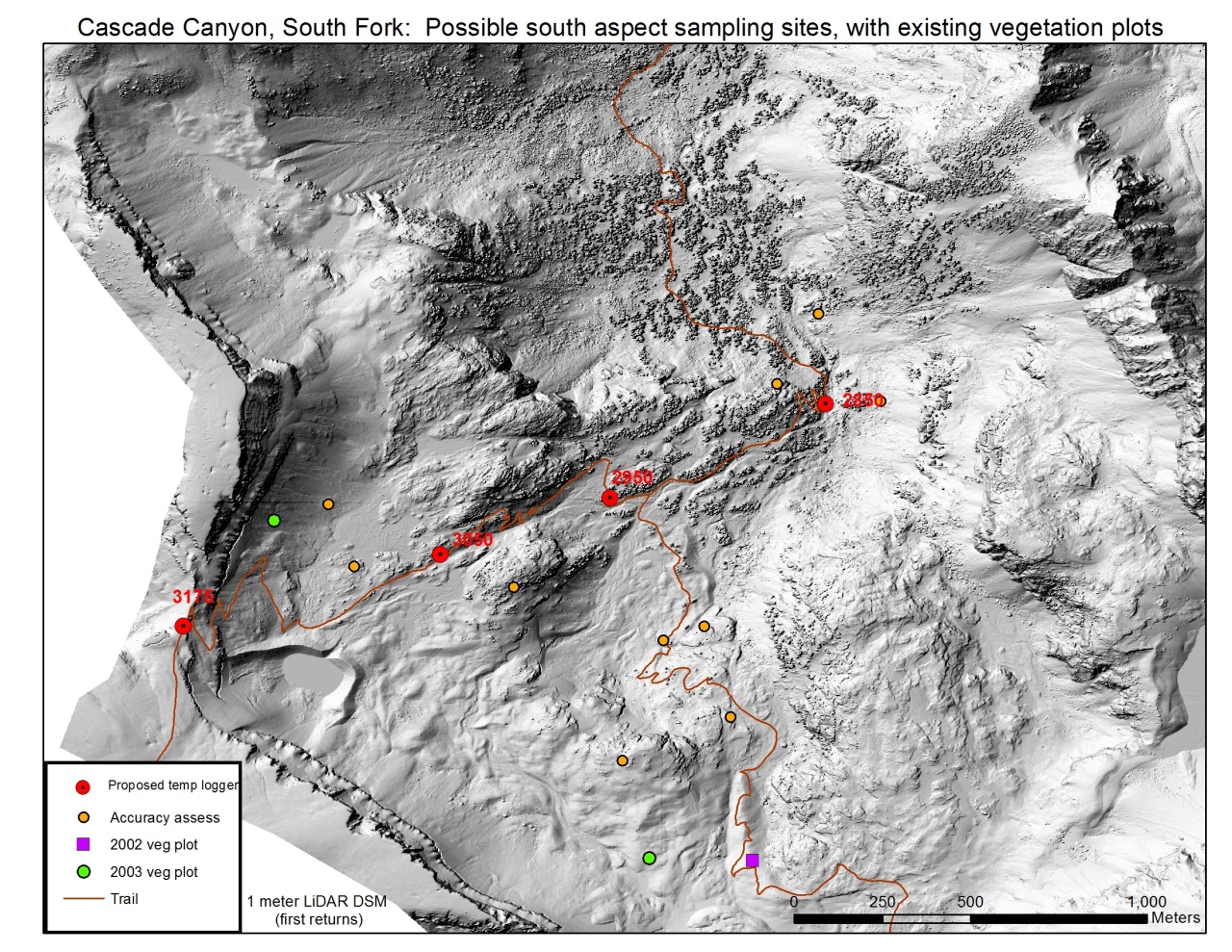
- The park compared and verified field surveys for high-elevation glacier monitoring of the Teton Range glaciers. The project included an accuracy assessment of GPS surveys of glacier elevation, alpine habitat changes, and glacier extents. Lidar was also used to pinpoint potential locations for high-elevation monitoring sites.
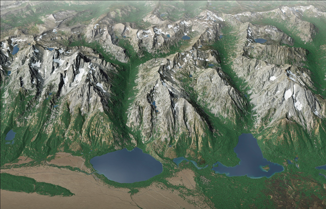
- The park is using visualization of the elevation data to create three-dimensional (3D) views and fly-through videos of the Tetons for field research planning and interpretive exhibits. In particular, the NPS Harpers Ferry Center has used the lidar data to create a spectacular 3D view of the Jenny Lake Trail Renewal project area.
The park plans to continue to use the lidar data and its derived datasets to support resource management. These projects include 1) habitat analysis of sage-steppe areas to characterize large sage (Artemisia tridentate vaseyana) canopy densities for sage-grouse; 2) forest edge analysis to support lynx habitat and fire fuels mapping; 3) mapping glacier extents and other high-elevation features using the bare-earth lidar data; and 4) updating the park vegetation dataset based on analysis of first-return and last-return vegetation heights.

Contour map (1 and 5 foot) of bridge replacement project area (B. Blankley, NPS).

Alpine monitoring site locations. North is oriented toward the top of the image.

A 3D view of Jenny Lake Trail area, with image facing west. Trailhead is on the south side of Jenny Lake, the round water body seen left-of-center in the lower part of the image. The other large lake to the lower right with a “J” shape is Leigh Lake. The trail circles Jenny Lake, traverses the eastern edge of Leigh Lake, follows both large canyons, and provides access to small lakes perched in the mountains. (T. Patterson, Harpers Ferry Center).

