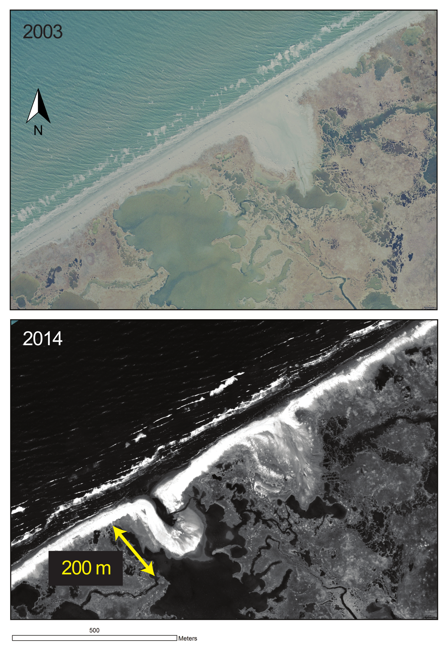
The NPS is using WorldView-2 high-resolution satellite imagery to monitor coastal change in Alaska's arctic national parks with the help of cooperators at the University of Alaska Fairbanks (UAF). The well-documented decrease in arctic sea ice cover in recent decades has raised concerns that the extensive coastlines of Cape Krusenstern National Monument and Bering Land Bridge National Preserve could be experiencing accelerated erosion and other detrimental impacts. The NPS obtained high-resolution satellite imagery in 2013 and 2014 through the USGS Commercial Remote Sensing Space Policy (CRSSP) program (http://crssp.usgs.gov/), and cooperators from UAF are comparing shoreline positions and coastal landforms on these images with those from earlier satellite images and historical aerial photographs. Preliminary results show interesting changes, such as the rapid erosion of ice-rich permafrost bluffs, large overwash events on low lying barrier islands, spit formation, and lagoon breaching.
http://science.nature.nps.gov/im/units/arcn/vitalsign.cfm?vsid=7
Between 2003 and 2014, the beach ridge on this barrier island in Bering Land Bridge National Preserve (Alaska) was breached by high waves to form a new overwash feature.

