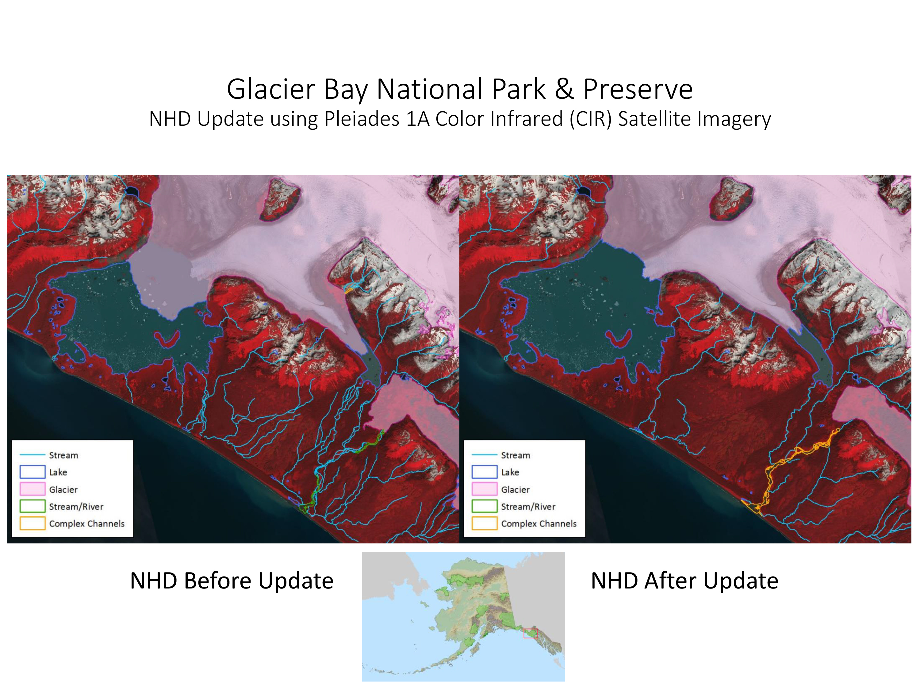
The GIS Team conducted a comprehensive update and densification of interior National Hydrography Dataset (NHD) data features for Glacier Bay National Park and Preserve (GLBA). The editing protocol for GLBA NHD updates was primarily a traditional image interpretation and manual data editing process. The key layers employed were Pleiades-1A, 0.5-m resolution, color infrared (CIR) satellite imagery for visual validation of hydrography features and Interferometric Synthetic Aperture Radar (IFSAR) elevation data for validating water flow paths across the landscape surface. The CIR image captures reflectance data in the visible green through near-infrared (NIR) wavelengths, helping interpreters to more effectively identify locations of water features since water clearly appears as black areas in the NIR wavelengths. This CIR image also shows the characteristics and types of vegetation, displayed as bright red tones, that is indicative of water presence. This project could not have been successful without high-resolution imagery and the detailed elevation dataset.

These two images show an area within Glacier Bay National Park and Preserve (GLBA) before (left) and after (right) the National Hydrography Dataset (NHD) data were updated to more accurately depict current hydrographic conditions.

