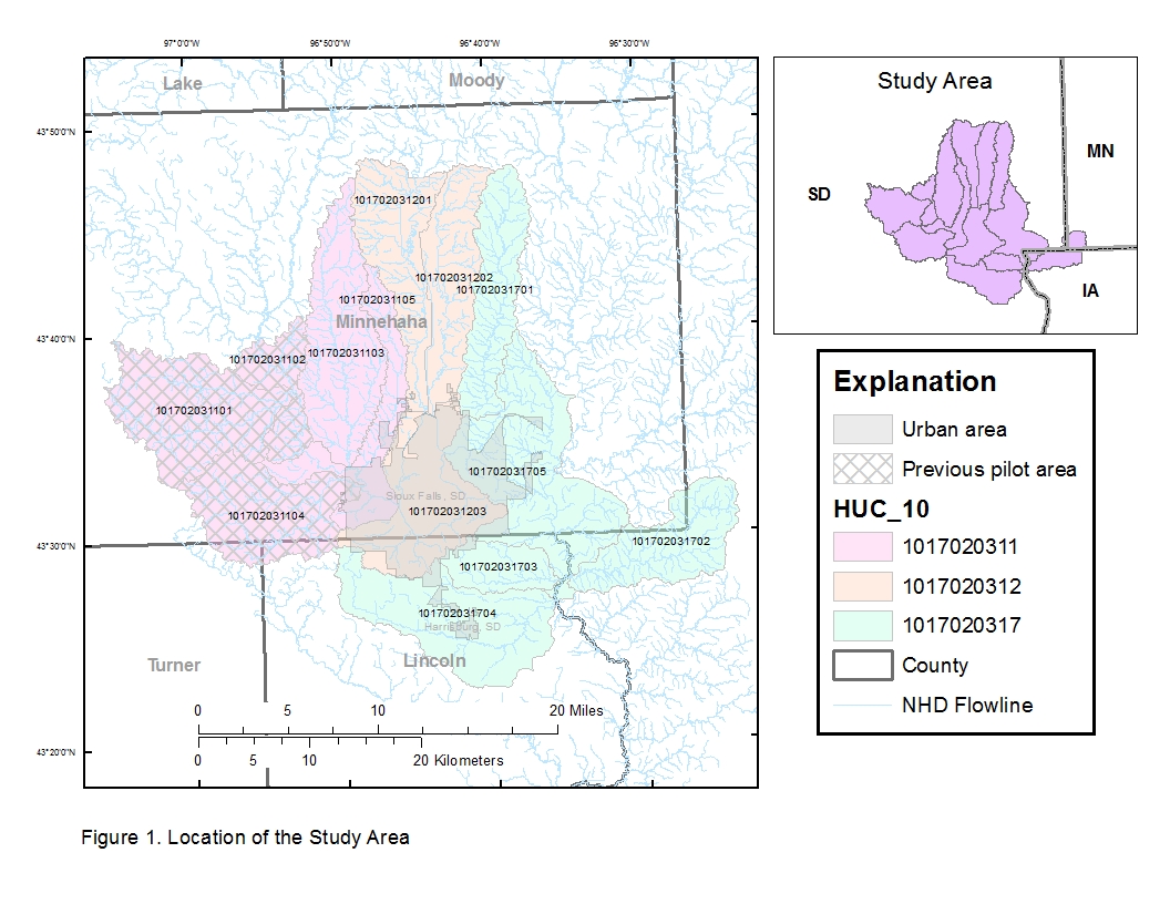
Building upon the methodology tested in an earlier pilot area, high-resolution hydrographic mapping is being completed on 10 additional 12-digit hydrologic units (i.e., subwatersheds) near Sioux Falls, South Dakota. As in the earlier pilot effort, a lidar-derived digital elevation model will be processed using selective drainage methods to hydro-enforce culvert locations into the modeled drainage network. The difference between this effort and the earlier pilot is that cooperating agencies will inventory culverts on roads where these data were not already available, as well as provide ground-truthing for assumed culverts and locations where the synthetic drainage network appears to depart from existing flowlines in the National Hydrography Dataset. The previous pilot area will also be ground-truthed and reprocessed as necessary. The lidar-derived watershed boundaries and surface drainage patterns will provide resource managers and urban planners with better detail and a more current picture of hydrographic features in the study area.
http://sd.water.usgs.gov/projects/HighResMapping/HighResMapping.html

Location of the study area for high-resolution hydrographic mapping.

