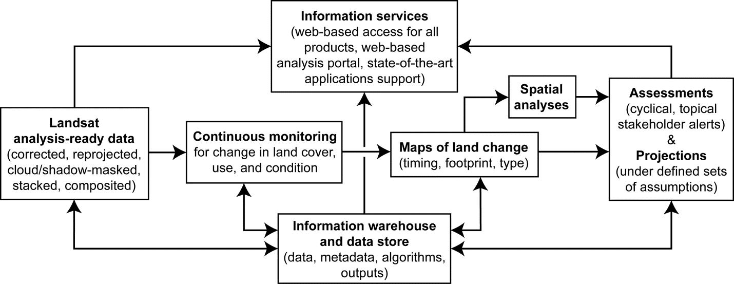
The USGS EROS Land Change Monitoring, Assessment, and Projection (LCMAP) initiative centers on structured, operational, ongoing, and timely collection and delivery of accurate and relevant data, information, and knowledge on land use, cover, and condition. LCMAP has the following overarching objectives that support a wide array of science questions: (1) provide documentation and understanding of historical land change and contemporary land change as it occurs; (2) explain how past, present, and future land change affects society, natural systems, and the functioning of the planet at local to global scales; (3) alert relevant stakeholders to important or emerging land change events in their jurisdictions; and (4) support others in the use of land change data, information, and science results.
LCMAP has its roots in a decade of science planning at the USGS and EROS Center. For example, the USGS 10-year strategy “Facing Tomorrow’s Challenges” repeatedly calls for information on land cover and land change to meet information needs across the Bureau’s strategic science directions. The centerpiece of LCMAP is a continuous land change monitoring capability that is supported by analysis-ready Landsat data and feeds an agile capacity to provide timely assessments for decision makers. LCMAP initially will be implemented for the conterminous United States and subsequently expanded to provide global coverage.

Conceptual schematic of the main, integrated components of the Land Change Monitoring, Assessment, and Projection initiative.

