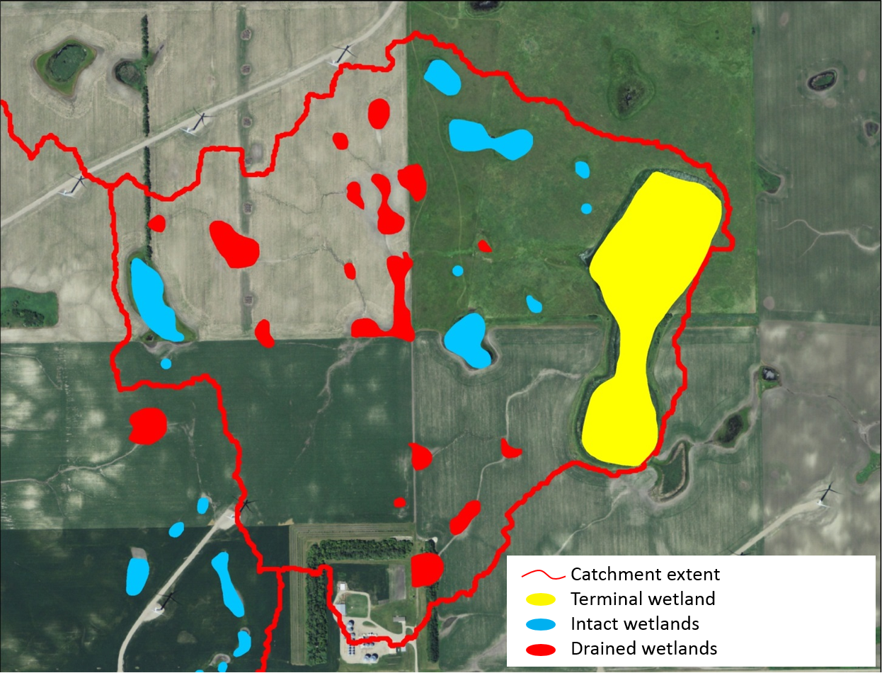
Depressional wetlands in the Prairie Pothole Region in the North American Great Plains are ecosystems that provide habitat for a diverse array of wildlife and multiple other services that benefit society (e.g., flood water storage, carbon sequestration). USGS scientists used high-resolution digital elevation models developed from lidar and synthetic aperture radar to delineate catchments for semipermanently and permanently flooded wetland watersheds (doi: 10.1007/s13157-014-0571-9). Scientists used historical aerial photography dating back to 1937 to assess the amount of wetland drainage that had occurred and how that has affected the hydrology of terminal wetlands in the watershed (doi: 10.1890/ES14-00494.1). Defining catchments for wetland complexes provides a spatial context to understand how landscape modifications have impacted wetland ecosystems and the services they provide to society.
http://www.npwrc.usgs.gov/node/2342

Watershed of a semipermanently flooded wetland in Barnes County, North Dakota.

