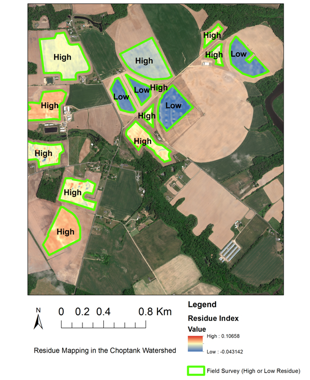
Crop residues play an important role in agricultural conservation, serving as a protective layer on agricultural fields, shielding soil from wind and water, preventing erosion, reducing moisture loss, and increasing soil carbon storage. Accurate assessment of the extent of crop residue is necessary for tracking the implementation of conservation tillage practices. Traditionally, residue is assessed using in-field observations. However, these methods are not cost-effective over large land areas.
Satellite remote sensing can provide the ability to map crop residue at the landscape scale. However, crop residues and soils appear similar in the visible near-infrared spectrum, limiting the effectiveness of typical moderate resolution satellites for mapping tillage intensity. USGS scientists have utilized data from the recently launched WorldView-3 satellite, which includes reflectance measurements in the shortwave infrared portion of the electromagnetic spectrum to map crop residue using the cellulose adsorption features found at wavelengths of 2090 and 2300 nm.
Fieldwork was conducted in spring 2015 on farmland along the Eastern Shore of Maryland. Preliminary results show a strong relationship between in-field crop residue measurements and satellite reflectance indices, providing a technique to map tillage intensity on farm fields. As satellite technology develops, increased spectral resolution will result in improved capabilities to monitor the implementation of conservation tillage for the protection of farmland resources.

Spectral indices calculated using shortwave infrared reflectance from the WorldView-3 satellite showed strong correlation with in-field measurements of crop residue obtained in spring 2015.

