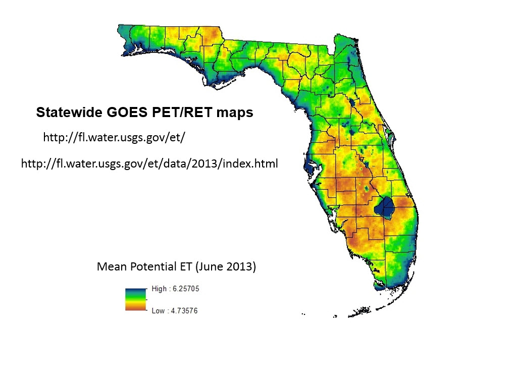
A fragmented approach was used historically to develop evapotranspiration (ET) estimates in Florida, which are essential for all aspects of water management, including agricultural water-use estimation, permitting, research, regulation, and planning. The USGS Florida Water Science Center initiated a multi-year project in 2006 to create spatially continuous, high-resolution ET maps for the entire State of Florida in cooperation with the Suwannee River, Northwest Florida, St. Johns River, Southwest Florida, and South Florida Water Management Districts. The goal of the project was to create potential (PET) and reference (RET) ET maps in Florida that were spatially continuous and calculated using consistent methodology.
http://www.intechopen.com/books/evapotranspiration/use-of-visible-geosta...

Mean monthly potential evapotranspiration in Florida, in millimeters per day, June 2013.

