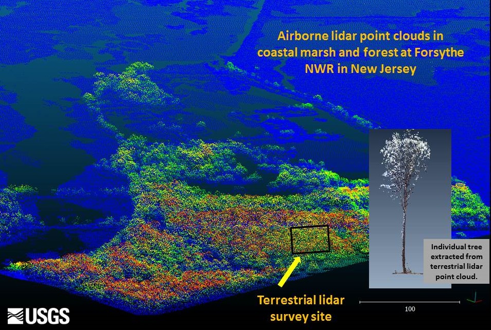
Hurricane Sandy wind and storm surge damaged large areas of coastal forests in the northeastern United States in 2012. Airborne lidar has been used to quantify the effects of hurricanes and other disturbances by measuring vegetation characteristics such as vegetation height, percent canopy cover, biomass, and presence of forest understory. An analysis of structural changes in forest and wetland vegetation is being conducted based on pre- and post-storm airborne lidar point clouds along a gradient of wind and storm damage in the Hurricane Sandy impact region. At selected field sites, a terrestrial lidar system was also used to map the forest canopy at a much higher level of detail; field measurements were taken of individual trees in order to calibrate the lidar-derived forest metrics with an independent dataset. In addition to quantifying hurricane impacts on forests, the lidar-based metrics will provide unique geospatial information on forest structure for models of wildlife species occurrence and habitat quality. Nationwide, a wealth of underutilized aboveground lidar point cloud data continue to be collected through the 3D Elevation Program (3DEP), providing opportunities to efficiently map and monitor vegetation communities over extensive regions of the United States.

Perspective view of Light Detection and Ranging (LiDAR) results showing an aerial LiDAR image of Edwin Forsythe National Wildlife Refuge, New Jersey (view from the southwest ), and example image of an individual tree extracted from a terrestrial LiDAR scan of the same area (inset). USGS scientists are using these data to assess forest vegetation damage due to Hurricane Sandy. (Image credit: Cindy Thatcher).

