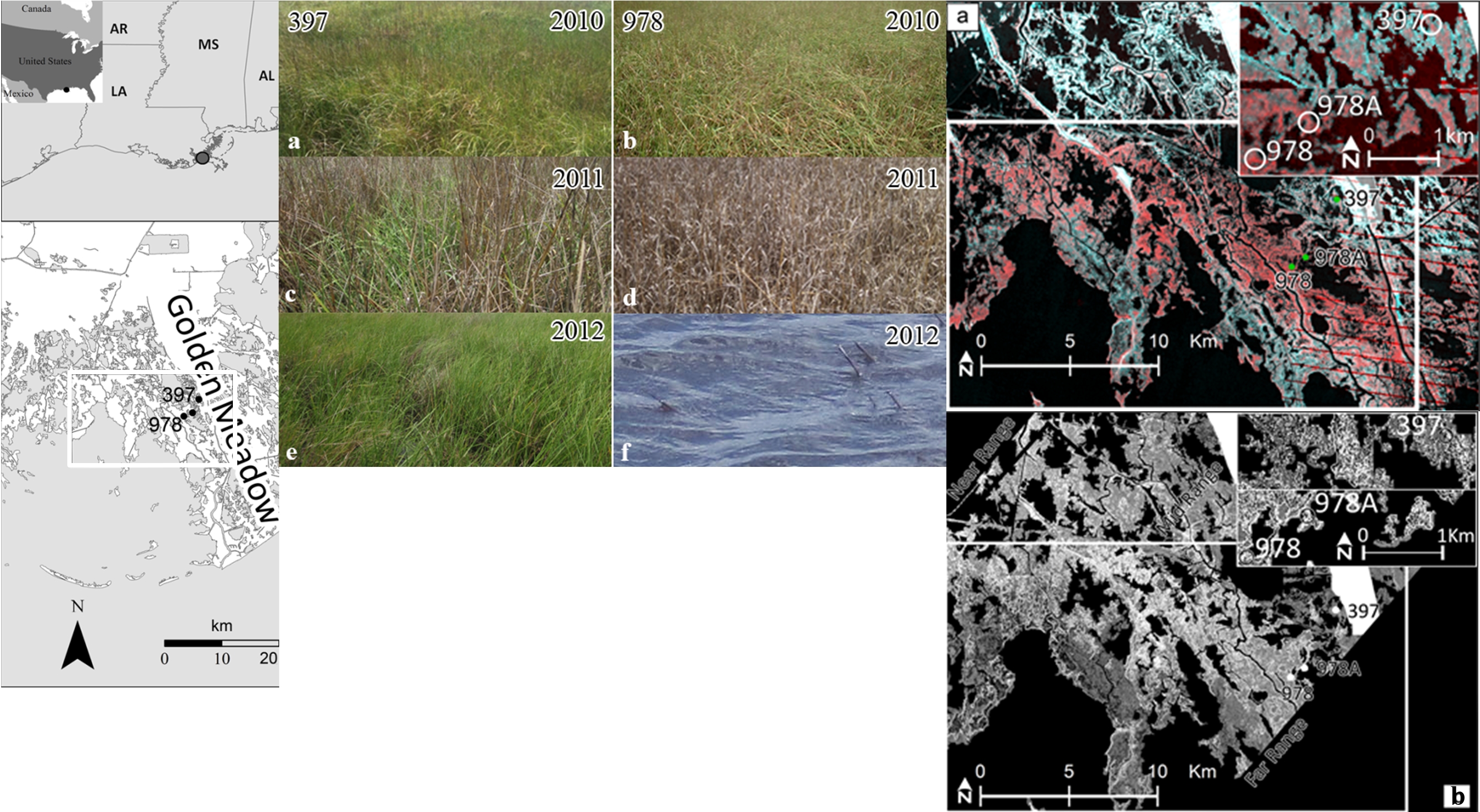
The dynamics of coastal marsh dieback, recovery and loss are documented using a combination of optical and radar remotely sensed data. Landsat Thematic Mapper (TM) and Satellite Pour l'Observation de la Terre (SPOT) satellite-based optical sensors, NASA Uninhabited Aerial Vehicle Synthetic Aperture Radar (UAVSAR), and field data captured the occurrence of and recovery from an undetected dieback of wetland vegetation between the summers of 2010, 2011, and 2012 in the Spartina alterniflora marshes of coastal Louisiana. Field measurements recorded the dramatic marsh biomass decrease from 2010 to 2011 and a biomass recovery in 2012 dominated by a decrease of live biomass. The optical vegetation index (opt-VI) mapping found the field-observed marsh dieback comprised 6,650 ha of an 18,292-ha S. alterniflora coastal marsh. Radar data similarly delineated the dieback, and as in the opt-VI mapping, tracked the subsequent regional recovery and detected localized loss. Both radar and opt-VI dieback-recovery mapping linked the dieback to abnormal pre-dieback growth in 2010 and to a parallel but more subtle regional trend that was exaggerated in the dieback marshes. The mapping demonstrated for the first time the ability to combine all-weather and day-and-night radar with optical images to capture the onset of detrimental changes in order to promote management mitigation before irreversible loss.
(http://dx.doi.org/10.1016/j.rse.2014.07.002)
http://www.sciencedirect.com/science/article/pii/S0034425714002478

(Left) S. alterniflora study area (white box) and the Golden Meadow field sites. (Center) field photos showing S. alterniflora marsh at sites 397 (a, c, e) and 978 (b, d, f). The green is live and brown is dead marsh. In 2012, marsh at site 978 converted to open water. (Right) a) the opt-VI image shows the 2010 to 2011 S. alterniflora dieback in red and the non-dieback marshes in bluish tones. b) The radar 2010 and 2011 difference image depicts the 2010 to 2011 marsh dieback in light gray and the non-dieback marsh as dark gray.

