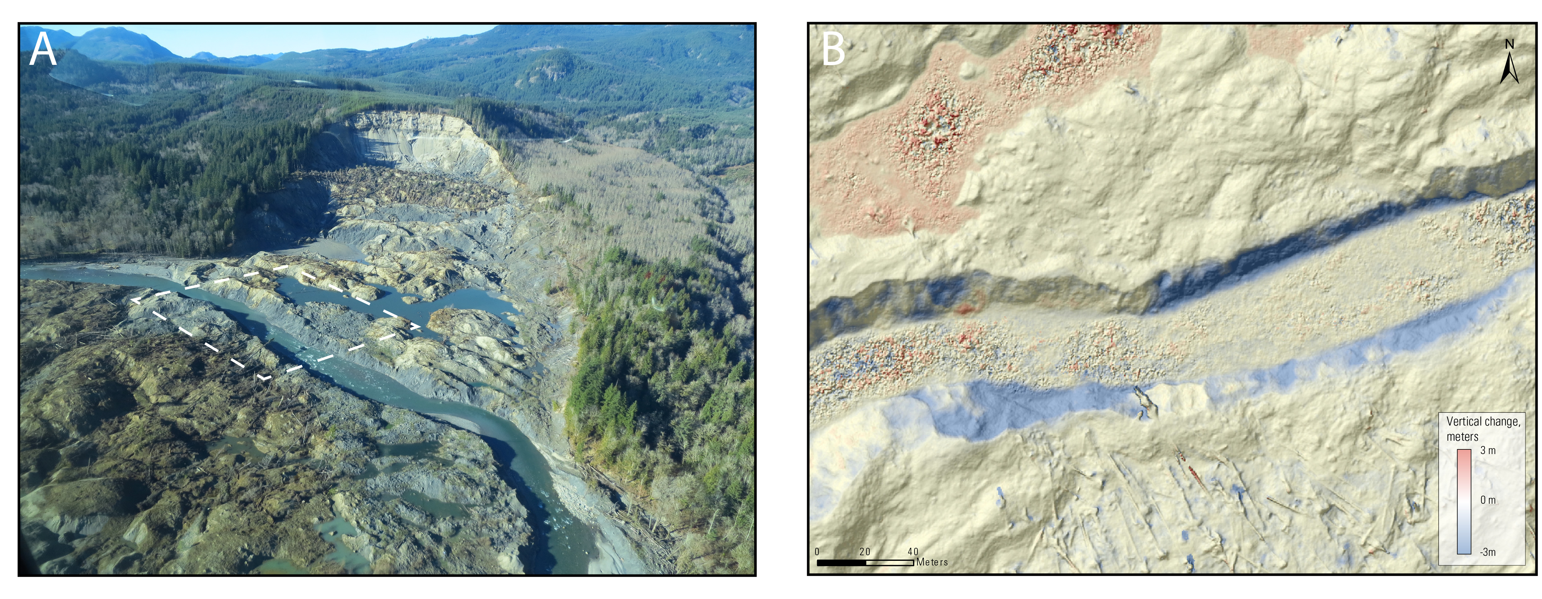
The massive Oso landslide in western Washington State deposited material over the entire width of the North Fork Stillaguamish River valley, causing the river to pool until water overtopped the landslide deposit and began incising a new channel. The uncertain stability of this new channel poses a potential hazard to the adjacent highway, while its progressive deepening and widening represents a substantial source of sediment into the river.
To monitor the evolution of the newly formed channel, USGS scientists used a photogrammetric technique known as Structure from Motion (SfM). Conceptually similar to the process of extracting elevations from photo stereo pairs, SfM takes advantage of modern computational power and advances in computer vision to rapidly generate dense three-dimensional point clouds from photos that image a scene from multiple perspectives. Using a simple point-and-shoot camera mounted to a small plane, scientists generated 0.5-m digital elevation models with positioning accuracies on the order of centimeters. The low cost per flight, in combination with the quick and straightforward processing pipeline, allowed scientists to acquire detailed topography every 2–3 weeks over the entire flood season and provide regular checks on changing channel alignments, as well as accurate estimates of erosion volumes.
http://wa.water.usgs.gov/projects/sr530/remotesensing.htm

A) Photo of the Oso landslide, taken January 29, 2015. Dashed white rectangle indicates extents shown in panel B. Photo A on left faces northeast; see north arrow in panel B.
B) Example topography derived from aerial photographs using Structure from Motion (SfM), overlaid with change since a previous survey; bank erosion (blue) and filling of the sag pond to the north of the channel (red) stand out. Linear features at the bottom of the image are downed trees.

