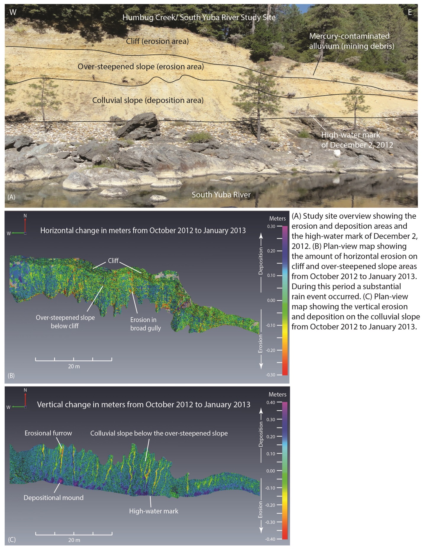
At the Humbug Creek/South Yuba River study site in northern California, the USGS Western Remote Sensing and Visualization Center (WRSVC) has utilized tripod-mounted lidar to quantify the eroded and deposited volumes of mercury-contaminated sediment from 2011 to 2013. A mass balance of the measured erosion and deposition volumes provides an estimate of the amount of contaminated sediment transported below a historical high water mark. This calculated volume of contaminated sediment can be mobilized by the South Yuba River during a typical 5-year flood event, such as the flood that occurred on December 2, 2012. This flood was triggered by an “atmospheric river” precipitation event that produced 11.4 inches of rain in a 4-day period. During that time period, more than 100 m3 of sediment was eroded from the cliff and over-steepened slope areas with approximately 10 m3 transported below the historical high water mark.


