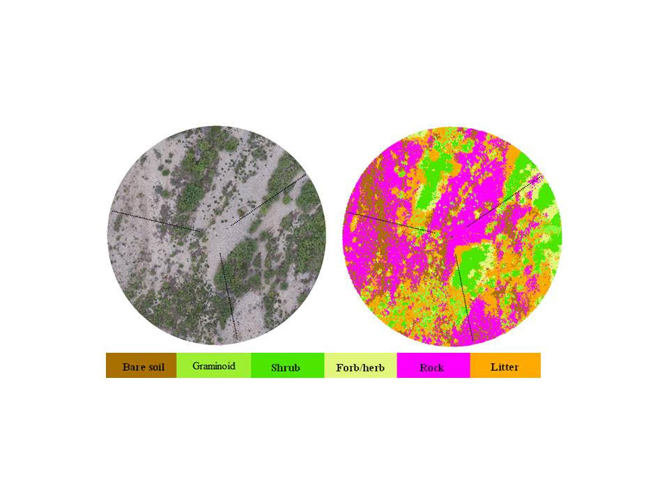
Assessment Inventory and Monitoring (AIM) methods are used to monitor landscape condition and trends across many BLM-managed lands. However, the derived fractional cover estimates, which are used to equate field-based AIM measurements with broad-resolution remotely sensed imagery (e.g. Landsat), only tell a fraction of the ecological story. To supplement and extend information extracted with AIM methods, BLM crews are flying Unmanned Aerial System (UAS) missions to collect very high resolution imagery capable of discriminating individual plants identified during field data collection.
Field-based AIM methods survey at discrete locations; in a typical plot, plants are sytematically identified at 150 points along defined transects (small black dots in the graphics). The sampled vegetation proportions are then extrapolated to the entire plot using spatial statistical techniques. On the basis of the very high resolution UAS imagery, researchers can make an unprecendented link between individual plants identified using the AIM protocol and remote sensing imagery.
To date, flight data have been collected in northern Alaska; near Boise, ID; Meeker, CO; and Susanville, CA. The data are being used to perfect methods with the goal of identifying plant life forms and land cover types across 100% of the ~2,000 m2 plots. This method has the profound potential of transforming AIM plots from a landscape-scale estimator of ecological condition into a spatially enabled site-scale remote sensing tool, providing information comparable to field survey data and enabling analysis across scales.

Very high resolution aerial imagery collected with Unmanned Aerial Systems allows researchers to map land cover and life forms across Assessment Inventory and Monitoring plots. Image shows true color imagery (L) and classified image (R). Transects (dotted black lines) are 25 m long.

