The BLM has increasingly used an emergent computing platform known as Google Earth Engine (GEE) to harness remote sensing data for resource management. GEE provides a development environment that combines over 2 petabytes of imagery and other scientific datasets with a suite of spatial and aspatial analysis tools. GEE offers a cloud computing architecture for accessing, processing, analyzing, and generating products from satellite imagery and other geospatial data without taxing local computer resources with intensive processing. An extensive image archive, including data from Landsat, Moderate Resolution Imaging Spectrometer (MODIS), Sentinel-1A, and Sentinel-2, is available for analysis within GEE. Using GEE, the BLM can efficiently retrieve available moderate-resolution remotely sensed time series information for a geographic point, field plot, BLM allotment, or other pertinent spatial unit of analysis to generate spectral indices used to address key science questions pertaining to phenology, land cover type, and condition. The BLM is continuing to develop scripts in GEE to automate data collection and analysis procedures. Of particular interest is the ability to develop landscape-scale cover predictions from imagery holdings and BLM field plots using GEE classification algorithms.

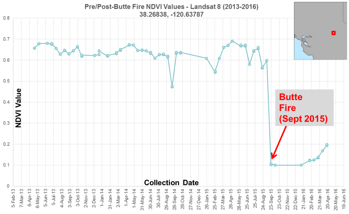
Time series profile of the Normalized Difference Vegetation Index (NDVI) derived from Landsat 8 data reveals the dramatic decline in NDVI due to the Butte Fire. NDVI is correlated to the amount of vegetation on the ground, with high values pre-fire and low values post-fire.

