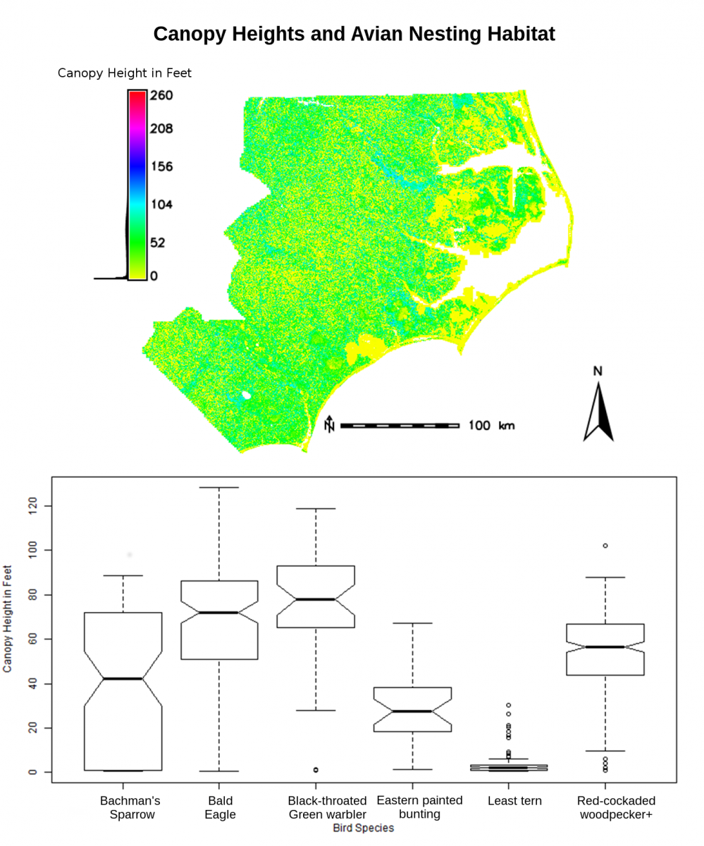
Lidar data are being leveraged to characterize avian nesting sites. Forty counties having USGS Quality Level 2 lidar data in eastern North Carolina (240.5 billion points) were processed to extract vegetation structure metrics such as canopy height, lidar point Z variance, and skewness. The resulting datasets were compared to 25-m buffered areas around nest locations for avian species with diverse habitat requirements. This method will aid in the identification of species habitat across the work area.

Lidar-derived canopy heights for 40 county areas in eastern North Carolina and associated avian nesting habitat data from 25-m buffers. Sparrows nest in a wide range of canopy heights. The Least tern and Black-throated Green warble nest in the low and high canopy extremes, respectively.

