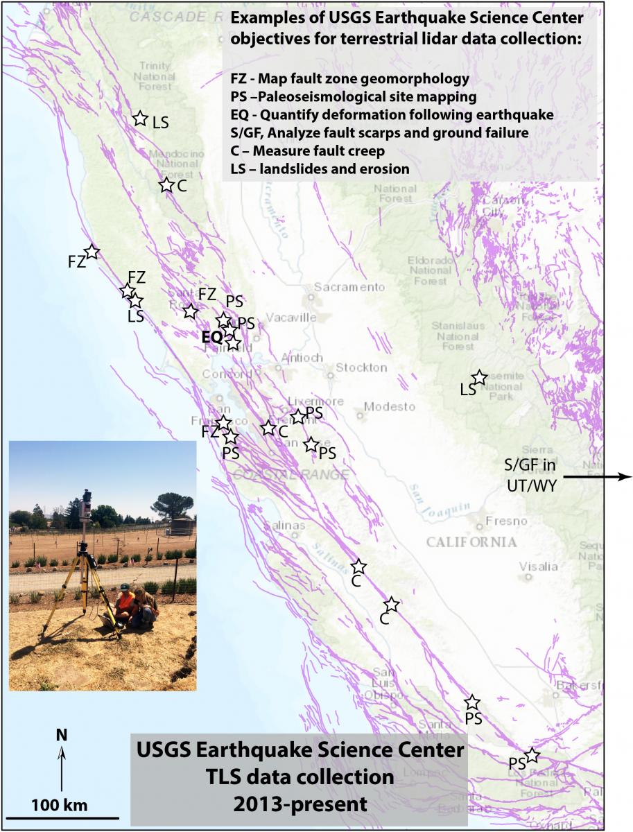
The USGS Earthquake Science Center uses a 3D laser scanner to study surface deformation associated with active faults, to map fault zones, and to perform detailed analyses of landscape change associated with earthquakes, landslides, wildfires, and other natural phenomena. Specifically, these studies have allowed researchers to determine three-dimensional patterns of landscape deformation resulting from the 2014 South Napa Earthquake (http://www.geosociety.org/news/pr/2015/15-90.htm), have provided information to the National Park Service and San Francisco Public Utilities Commission regarding the magnitude of erosion affecting water quality following the 2013 Rim wildfire in Yosemite National Park, and have provided valuable mapping of fault zones to better locate research excavations and understand extent of surface deformation. In-progress work includes use of terrestrial lidar to measure aeseimic creep (surface deformation that occurs without damaging earthquakes) and landslide activity. USGS earthquake scientists also collaborate with researchers that operate small unmanned aerial vehicles (UAVs or drones) in order to assess error inherent in that emergent technology and to improve current methods of rapidly mapping areas affected by natural hazards.

The USGS Earthquake Science Center has collected terrestrial lidar data in many locations with diverse scientific objectives: PS – characterization of paleoseismological sites; FZ – map fault zones under canopy where airborne lidar resolution is insufficient; EQ – quantify coseismic and postseismic landscape deformation following earthquake (e.g. 2014 South Napa Earthquake); S/GF – analyze fault scarps and ground failure/liquefaction features from prehistoric earthquakes; C – measure fault creep; LS – landslide/erosion studies (postfire, earthflows, etc). Most of these sites have the secondary objective of data collection to be used as pre-earthquake baseline ultra-high-resolution topographic data. Active faults are in purple.

