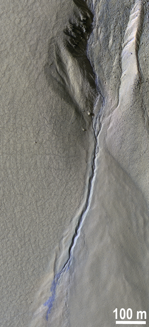
The High Resolution Imaging Science Experiment (HiRISE) camera on board the Mars Reconnaissance Orbiter captures the surface of Mars at higher resolutions than ever before obtained from an orbiter: image pixel sizes are as small as 25 cm. The capacity to deliver fine-scale detail serves one of the major science objectives of HiRISE, which is to track changes in Martian surface features.
Martian "gullies" have been studied extensively because they resemble water-formed features on Earth. After their discovery, they were initially thought to form by groundwater release or snowmelt. However, the monitoring campaign has revealed that they are active in the winter under extremely cold temperatures. This activity indicates that carbon dioxide (dry ice) frost, rather than liquid water, is responsible for creating the landforms. Scientists from the USGS and other institutions are now using HiRISE to monitor hundreds of locations on the surface and have discovered a diverse assortment of activity—some of it, like the gully flow shown in the image, driven by processes that do not occur on the Earth.

Portion of HiRISE image ESP_038546_1250 showing new deposits of sand and dust (that appear blue in the enhanced color image) from a gully on Mars. These deposits are knocked loose by carbon dioxide and appear distinct because they are not yet covered by red dust.

