The USGS Land Change Monitoring, Assessment, and Projection (LCMAP) initiative centers on structured, operational, ongoing, and timely collection and delivery of accurate and relevant data, information, and knowledge on land use, cover, and condition. LCMAP supports a wide array of objectives: (1) provide documentation and understanding of historical land change and contemporary land change as it occurs; (2) explain how past, present, and future land change affects society, natural systems, and the functioning of the planet at local to global scales; (3) alert relevant stakeholders to important or emerging land change events in their jurisdictions; and (4) support others in the use of land change data, information, and science results.
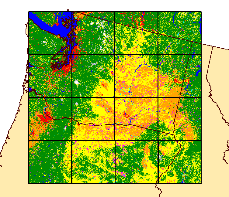
During the past year, significant progress has been made in implementing the first objective. The assembly of an “analysis-ready” Landsat archive is underway that will provide data cubes of Landsat 4–8 surface reflectance and top-of-atmosphere reflectance data for the U.S. that contain pixel-level quality assurance information to enable screening of clouds and cloud shadows. In addition, prototype 1985–2015 annual land cover and land cover change datasets have been completed for a large portion of the Pacific Northwest and another 10 sites around the country. By late 2017, LCMAP capabilities will include a routine continuous U.S. land change monitoring capability that is supported by analysis-ready Landsat data, all feeding an agile capacity to provide timely land change data and assessments for decision makers. LCMAP initially will be implemented for the U.S. but can be expanded to provide global coverage.

2011 land cover for a portion of the Pacific Northwest generated using automated LCMAP land classification capabilities.

