LANDFIRE, the Landscape Fire and Resource Management Planning Tools Program, is a vegetation, fire, and fuel characteristic mapping program managed by the U.S. Department of Agriculture Forest Service and the U.S. Department of the Interior, in partnership with The Nature Conservancy. LANDFIRE represents the first and only complete, nationally consistent collection of over 20 geospatial layers, databases, and ecological models depicting potential and existing vegetation, surface and canopy fuels, and fire regimes information that can be used across multiple disciplines to support cross-boundary planning, management, and operations across all lands of the United States and insular areas. LANDFIRE data products are designed to be used at landscape scales in support of strategic vegetation, fire, and fuels management planning to evaluate management alternatives across boundaries. LANDFIRE data products facilitate national and regional level strategic planning and reporting of wildland fire and natural resource management activities, as well as tactical incident response to large wildland fires.
The first LANDFIRE mapping effort began in 2004 based on Landsat data from circa 2001. Although many changes on the landscape have been captured through periodic updates using geospatial disturbance data and image-based change detection information, current LANDFIRE data products maintain this 2001 foundation. Additional landscape changes not captured in the disturbance data, subtle vegetation and landscape changes from insects or disease damage or other sources, and mis-classifications in the original LANDFIRE data products are being addressed through development of a comprehensive remap process. The LANDFIRE remap effort provides an opportunity for the program to evaluate past production processes and methods of using remotely sensed and field data for map development. This review will include exploring additional mapping methods to maximize the use of the available data and past mapping efforts, and provide a characteristic representation of contemporary conditions for areas that are undergoing change.
As part of the LANDFIRE remap, newer spatial data sources will be investigated including Landsat 8, Sentinel-2, and lidar. New field plot data will also be incorporated including National Resource Conservation Service National Resource Inventory data. Finally, broadening program partnerships, including with the USGS Gap Analysis Program, will combine with these data sources to create a new base map data suite that improves upon the legacy LANDFIRE data products.

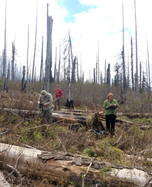
In this May 2016 image, LANDFIRE team members are pictured gathering new field data in a remap prototype area of central Idaho.

