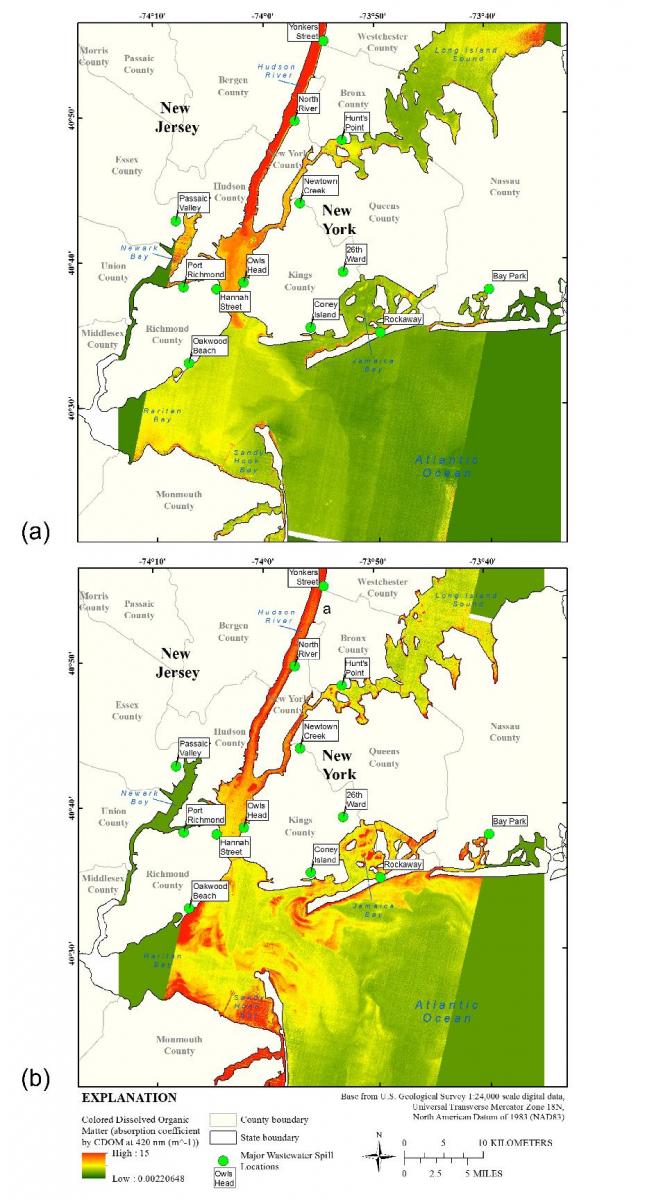
Colored dissolved organic matter (CDOM) is the humic-rich, optically active fraction of dissolved organic matter that is present in natural waters from the decomposition of detritus and other organic material. Also known as chromophoric dissolved organic matter, yellow substance, humic color, and gelbstoff, CDOM is an important measure of water quality and has important implications for drinking water, aquatic ecosystems, and metal transport. The Operational Land Imager (OLI) aboard Landsat 8 includes several technical improvements that create the potential for better monitoring of water quality from space. These improvements include increased radiometric resolution (from 8 to 16 bits), and the addition of a coastal aerosol band (433–453 nm), which is especially useful for monitoring water-quality properties, such as CDOM. In addition, the development of a surface reflectance product by the USGS Earth Resources Observation and Science (EROS) Center provides consistent, high-quality atmospheric correction of Landsat 8 data. Data from the Advanced Land Imager (ALI), the prototype for the OLI, during and after Hurricane Sandy show promising results in terms of areas of expected high CDOM before and after the hurricane. In addition, testing of Landsat 8 data against corrected CDOM data from USGS streamgage stations shows promising relationships that could lead to new satellite-based monitoring of colored dissolved organic matter.
http://www.sciencedirect.com/science/article/pii/S0025326X1630128X

Colored dissolved organic matter (CDOM) gradients extracted from Advanced Land Imager (ALI) multispectral data for September 12, 2011 (a) and November 21, 2012 (b). Points indicate locations of wastewater treatment facilities that failed during Hurricane Sandy, releasing untreated and partially treated sewage into New York and New Jersey waterways. Red areas indicate high levels of CDOM.

