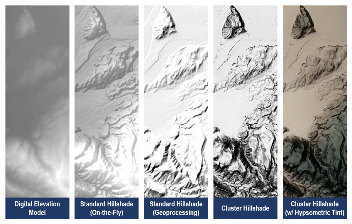
Hillshades are useful in depicting additional details in terrain and emphasizing variation in topography, which contributes to effective cartographic interpretation. However, digital hillshade products often exhibit unidirectional oblique illumination without localized variation, which limits the detail and three-dimensional appearance of hillshading and undermines its effectiveness. Unfortunately, effective and traditional hillshade methods have thus far required either manual creation or substantial digital post-processing that has been impractical for effective geoprocessing workflow implementation. Some past toolsets have attempted to improve hillshading through methods such as multi-directional oblique weighted hillshading but have produced results exhibiting levels of detail that de-emphasize major features. However, the advent of new techniques developed by Veronesi and Hurni (2014) now allows for advanced hillshading capabilities to optimize hillshaded relief. Using these techniques, this project provides BLM Wyoming with a statewide hillshaded relief dataset for a wide array of cartographic applications.
The foundational data for this project were the 2013 1/3-arcsecond (~10 m) digital elevation model encompassing Wyoming (with a one-degree buffer), mosaicked and resampled to an unsigned 16 bit-depth. Hillshading techniques described by Veronesi and Hurni (2014), and implemented by Esri (2015, May 21), were used to cluster topographic data by geographic aspect with follow-on processes that produced localized, multidirectional oblique illumination emphasizing major topographic features based on elevation. The result eliminated valley noise while emphasizing ridges, cliffs, channels, and other features to replicate previous manual methods of hillshaded relief perfected by Imhof (2007). The spatial resolution for the digital elevation model allows for hillshaded relief usage at scales as large as 1:50,000. Hypsometric tinting was created using raster functions that color map the digital elevation model, force it into red-green-blue color space, and then apply panchromatic sharpening to combine hypsometry with hillshading without loss of detail or chromatic fidelity. Resulting hillshaded relief datasets provide new base data with an exceptional amount of topographic detail, especially for cartographic production and interpretation.
https://www.arcgis.com/home/item.html?id=4b2ea7c5f87d476a8849c804b81667aa
https://books.google.com/books/about/Cartographic_Relief_Presentation.html?id=cVy1Ms43fFYC
http://www.tandfonline.com/doi/abs/10.1179/1743277414Y.0000000100?journalCode=ycaj20

Comparison of hillshade methods with a baseline digital elevation model.

