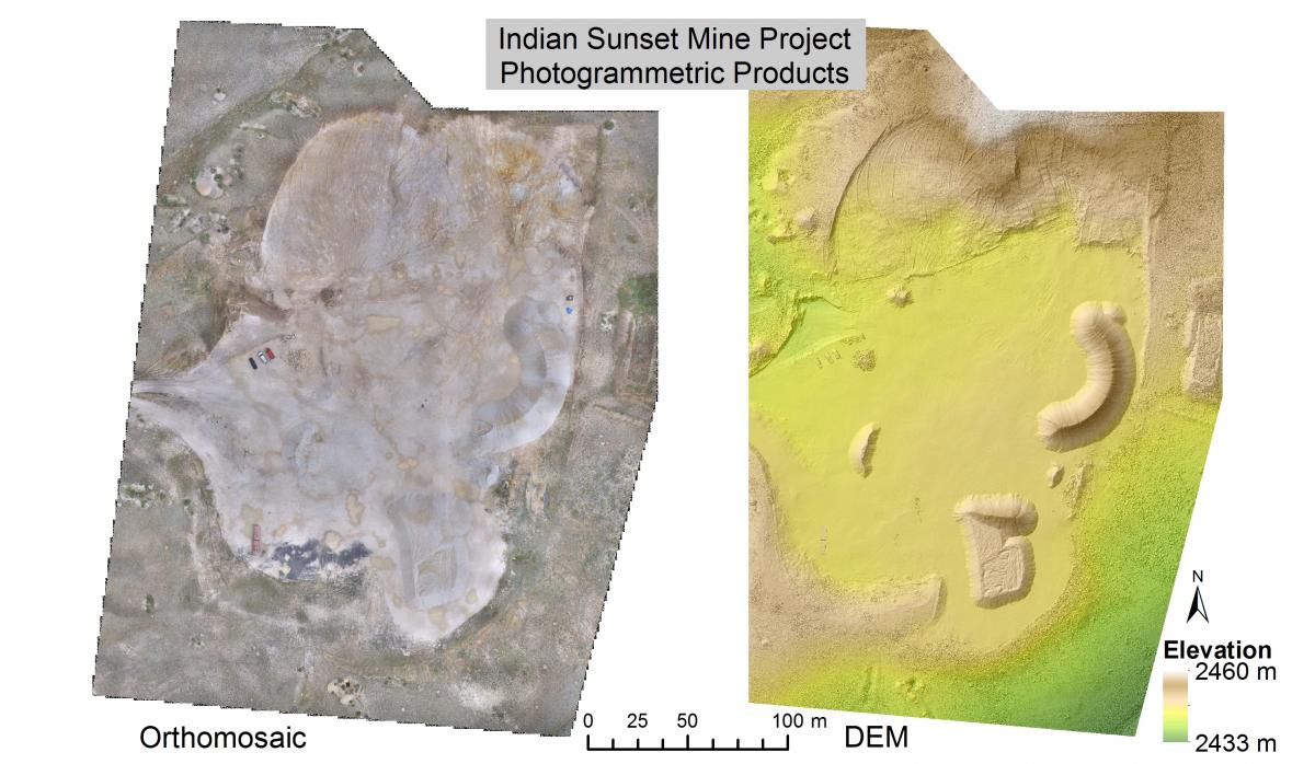
The BLM National Operations Center (NOC) regularly assists field offices with photogrammetric and remote sensing projects involving Unmanned Aerial Systems (UAS) in a variety of natural resource management applications. The NOC is currently providing subject matter expertise to the Royal Gorge Field Office (RGFO) in Canon City, Colorado, as part of an ongoing pilot project leveraging the use of multi-scale remotely sensed data for mine production verification (PV). The current PV model is labor-intensive, includes extensive field work, and is cost prohibitive, which results in a less than optimal number of mine operations being verified. Working in conjunction with the NOC, the RGFO purchased high-resolution imagery of the Indian Sunset Mine site near Westcliffe, Colorado, from Leptron Unmanned Aircraft Services, LLC. The imagery captured the mine site areas-of-interest undergoing mineral extraction, as well as the product pile(s) of aggregate material to be verified. NOC personnel then applied a rigorous photogrammetric workflow to measure both the volume of material removed from the site and the volume of the product pile(s). PV monitoring using UAS provides comparable results to ground-based surveys, saving time and money.

High-resolution orthomosaic and elevation model spanning the Indian Sunset Mine.
High-resolution photogrammetric-derived area and volumetric estimates for the Indian Sunset Mine.

