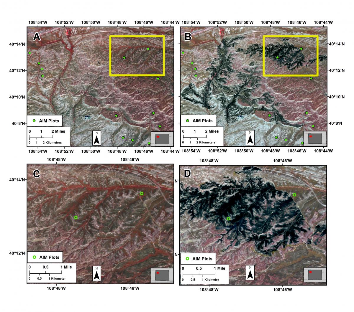
The BLM has instituted field-based Assessment, Inventory and Monitoring (AIM) methods to characterize ecosystem condition and trends for public lands. AIM provides a statistically valid sampling strategy facilitating standardized measurements, and allows comparison of these data collected in different places and over time, for many different purposes. The BLM is efficiently and accurately identifying existing AIM plots severely impacted by wildfires (or other major disturbance events) using publicly available Sentinel-2 multispectral imagery. Normalized Difference Vegetation Index (NDVI) data are calculated from pre- and post-fire imagery. Finally, a differenced NDVI (dNDVI) is derived that can be used to identify locations for AIM plots within burned areas. This strategy provides BLM field officials the ability to monitor the condition of AIM plots long after they have been sampled at a spatial resolution much higher than other synoptic imaging systems. In many cases, this can prove more timely and accurate than using available fire perimeter data. This capability is relevant for future AIM sample site selection and, more broadly, the efficient and timely identification of habitat disturbances—and recovery—across the landscape.

Figures A and B: Sentinel-2 imagery acquired before and after the Dead Dog Fire in northwestern Colorado in May and June 2017, respectively. Assessment, Inventory and Monitoring (AIM) plot locations are in green. Figures C and D: close up of pre- and post-fire Sentinel-2 imagery identifying an AIM plot disturbance. AIM plots locations are in green.

