Models of animal density commonly use coarse land cover categories that homogenize vegetation attributes, thereby limiting specificity of results. Alternatively, models including land surface phenology (LSP) metrics derived from Moderate Resolution Imaging Spectroradiometer (MODIS) imagery capture continuous data describing plant growth and senescence. LSP metrics may better discriminate the vegetation conditions influencing species habitat and distribution. Additionally, applications modeling animal density often use clusters (i.e., groups of individuals) but omit differences in cluster sizes. Ignoring how cluster size varies with landscape characteristics risks misrepresenting the spatial distribution of an animal’s density.
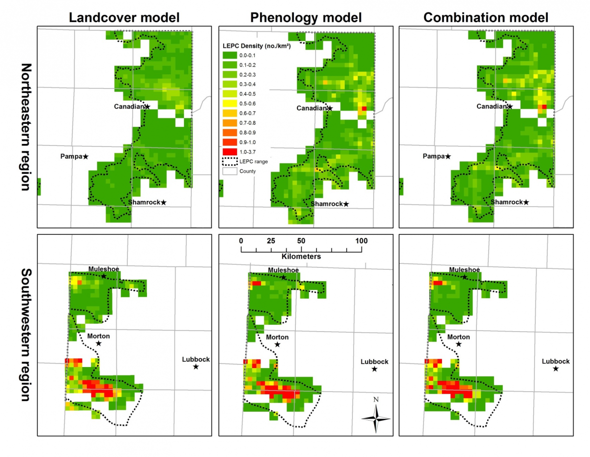
Using lesser prairie-chickens (LEPC; Tympanuchus pallidicinctus) as an example, FWS researchers integrated the spatial distributions of cluster density and cluster size with LSP metrics to better predict their density in Texas. The team modeled LEPC cluster density using hierarchical distance sampling and cluster size with zero-truncated generalized linear modeling. Variables included land cover categories, LSP metrics, human infrastructure, and topography. Models incorporating LSP metrics received most support and identified conservation areas that land cover models missed in the northern portion of the Texas Panhandle. Cluster density correlated with LSP metrics, road density, oil and gas well density, topography, and grassland to shrubland ratio. Cluster size correlated with topography and LSP metrics. Omitting the spatial distribution of cluster size underestimated LEPC density.
This approach generates geospatial predictions for prioritizing LEPC protection and habitat restoration, and evaluating impacts from development or phenological change. This study demonstrates the utility of integrating LSP metrics, cluster density, and cluster size for predicting species density across large and heterogeneous landscapes, and the results have been accepted for publication in the journal, Remote Sensing of Environment.

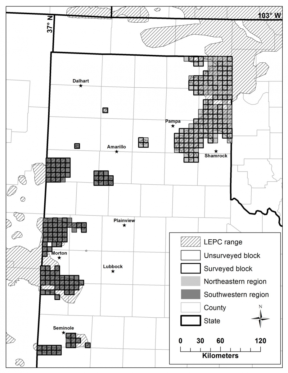
Sampling frame of 285, 7.2-km × 7.2-km blocks (208 blocks surveyed) encompassing occupied range of lesser prairie-chickens (LEPC) in Texas.

Lesser prairie-chicken (LEPC) density (no./km2) per quadrat for models receiving most support from three model sets, 2010–2011, Texas. The combined model included land cover and land surface phenology (LSP) metrics. Incorporating LSP metrics improved specificity of spatial predictions.

