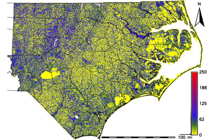
Vegetation structure raster layers developed from lidar data are used in a variety of resource management applications. The ongoing lidar analysis from the USGS QL2 data collected in North Carolina has been expanded to an analysis of 360 billion lidar points over 60 counties, producing rasters at a 20-ft (6.096-m) horizontal resolution. Structure layers include canopy height, lidar Z value skewness, percent of lidar points 1–3 m aboveground, and percent of points 3–7 m aboveground.
The canopy height layer has been used to create a binary forest/nonforest layer, which is used for forest fragmentation analysis across the 60-county area to determine the extent and location of contiguous forest areas to assist in planning conservation efforts for maximum effectiveness. The canopy height layer was also used to create a height class layer including subshrub, shrub, and forest broken up into 5-m height intervals, with a building class included from a separate data layer. Both this dataset and the forest/nonforest layer are being used to characterize extent of vegetative cover within USGS 12-digit Hydrologic Unit Code (HUC) subbasins. The raster layers were also masked to the Southeast Aquatic Connectivity Assessment Project (SECAP) Active River Areas (ARA) and similar statistics calculated for forest/nonforest and vegetative classes for the ARA zone within each USGS 12-digit HUC subbasin.
Further exploration of the above data layers will include intersecting the rasters with buffered locations of avian species of interest from the North Carolina Natural Heritage Program (http://www.ncnhp.org/) dataset and the Global Biodiversity Information Facility (GBIF, http://www.gbif.org/) dataset.

Lidar-derived 20-ft horizontal resolution canopy height (in feet) for eastern North Carolina.

