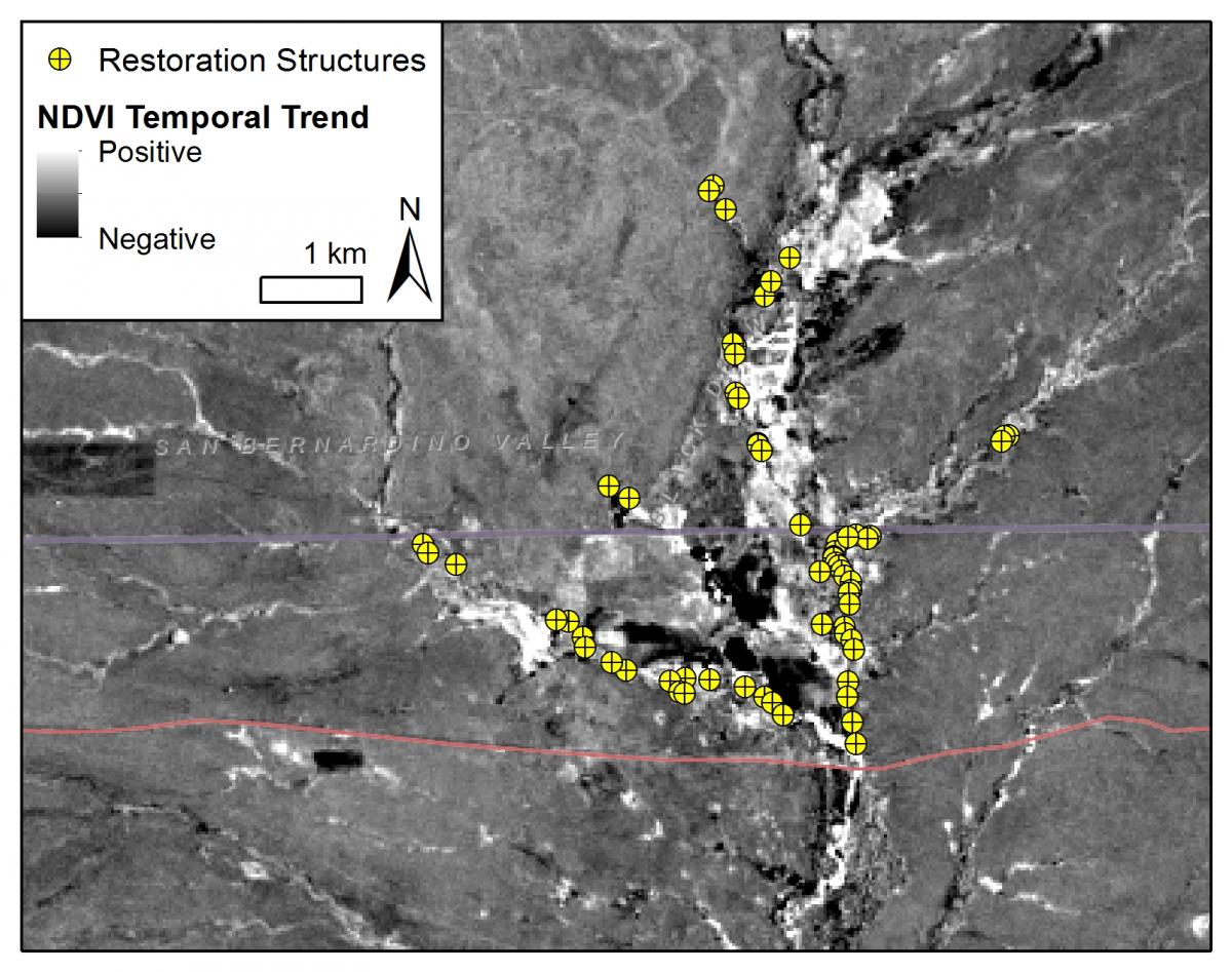
Watershed restoration efforts have been made to rejuvenate vegetation, biological diversity, and land productivity at Cienega San Bernardino, an important wetland in southeastern Arizona and northern Sonora, Mexico. Previous research findings show that restoration supports and even increases vegetation health despite ongoing drought conditions in this arid watershed. However, the extent of restoration impacts is still unknown despite qualitative observations of improvement in surrounding vegetation amount and vigor. Rock detention and earthen berm structures were built on the Cienega San Bernardino over the course of four decades, beginning in 1984 and continuing to the present.
USGS scientists analyzed spatial and temporal trends in vegetation greenness and soil moisture by applying the Normalized Difference Vegetation Index (NDVI) and Normalized Difference Infrared Index (NDII) to one dry summer season Landsat image from 1984 - 2016. Long-term trends were identified by linear regression and tested for monotonicity using the Mann-Kendall test. A threshold was developed for both indices to identify areas of healthy vegetation in the riparian corridor; the resultant areal trends were identified using linear regression. Correlation to spring precipitation was analyzed and short-term temporal patterns in vegetation response identified. These analyses were applied to zones that were delineated based on topographic and hydrologic relationship to restoration.
Restoration impacts are recognized using higher greenness and vegetation water content levels, greater increases in greenness and water content through time, and a decoupling of vegetation greenness and water content from spring precipitation when compared to control sites in nearby tributary and upland areas. Restoration impacts were detected up to 5 km downstream of restoration, however, the presence of a village confounded analysis from 6 to 10 km downstream. Further than 10 km downstream, no restoration impacts were identified. In addition to extending downstream, restoration impacts were also detected at least 1 km upstream of restoration structures. These results confirm the hypothesis that restoration impacts extend beyond the immediate area of restoration, demonstrating contiguity for 5 km downstream and 1 km upstream. This information is important for water policy-makers and restoration practitioners. The installation of erosion control structures at desert cienegas may not decrease water availability downstream but, instead, can provide long-term water-storage opportunities that riparian obligates can harvest over time.

Temporal analysis of a 30-year Landsat dataset. Impacts of watershed restoration structures analyzed using trends in vegetation greenness calculated from NDVI.

