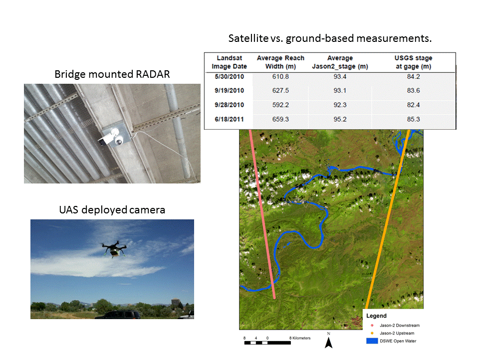
Monitoring streamflow from large, remote rivers like those in Alaska is costly and hazardous through conventional means. Therefore, the USGS is experimenting with methods to estimate Alaskan river streamflow through remote sensing. Current study areas include reaches on the Yukon, Tanana, and Chena Rivers. Methods under development rely in part on relationships among hydraulic variables and reach parameters that have been derived through analysis of tens of thousands of channel profiles and stage/discharge records collected by USGS hydrologists on the ground in streams and rivers across the United States (U.S. Geological Survey data release, http://dx.doi.org/10.5066/F7D798H6). To test the accuracy of these methods, USGS field crews are using conventional techniques to collect data on velocity, water heights, water slopes, channel shape, and discharge during periods of near-ground and satellite data collection. Near-ground cameras and radar instruments are mounted on tripods and bridges or deployed via Unmanned Aircraft Systems to provide near-continuous data that can be used to estimate river width, water height, and velocity. In addition to safely generating stream discharge estimates under flood conditions, these remote sensing systems are used to collect data as satellites are passing overhead so that satellite-based measurements can be directly compared to them. Examples of satellite-based measurements include reach width as derived from the USGS Landsat-based Dynamic Surface Water Extent high-level product, as well as both reach stage and slope, as estimated from satellite altimeter data like that collected by NASA’s Jason-2 satellite. Success in this endeavor would mean that information on streamflow, which is vital to science and hazard planning, can be collected safely and at lower cost than is possible through repeat visits by field personnel. This USGS-led research also contributes to technique development for the planned Surface Water Ocean Topography (SWOT) mission that is currently under collaborative development by United States, French, and Canadian space and Earth science agencies. SWOT will afford standard methods of streamflow and other water resource data collection and open dissemination worldwide.

Multi-stage remote sensing is used to develop and evaluate satellite-based streamflow measurement techniques. Radar mounted on bridges (upper left) provide measurements on water surface elevations (stage) and velocity. Unmanned systems (lower left) capture detailed imagery for river width and velocity estimation. These are compared with satellite estimates (right) of river stage and width.

