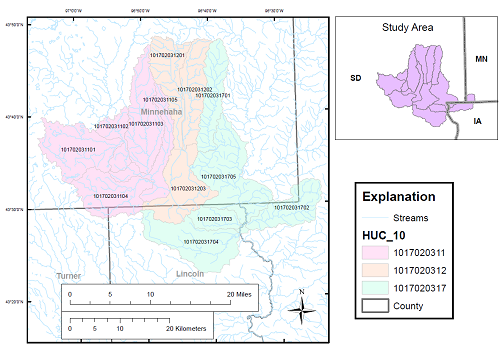
High-resolution hydrographic mapping, which provides essential data for flood mitigation and planning, is being completed on thirteen, 12-digit hydrologic units near Sioux Falls, SD. A lidar-derived digital elevation model is being processed using selective drainage methods to hydro-enforce culvert locations into the modeled drainage network. Many additional culverts were identified and inventoried as a part of this study and using selective drainage processing. Partners and cooperating agencies are providing ground-truthing for newly identified culvert locations and will field verify any locations where the synthetic drainage network appears to depart from existing flowlines in the National Hydrography Dataset. The lidar-derived watershed boundaries and surface drainage patterns will provide resource managers and urban planners with better detail and a more current picture of hydrographic features in the study area.
http://sd.water.usgs.gov/projects/HighResMapping/HighResMapping.html

Location of the study area.

