Susceptibility of slopes to landslides at high latitudes have increased due to degradation of permafrost in rock and soil, debuttressing of slopes resulting from glacial retreat, and changes in ocean ice cover. In the United States, the most severe impacts on slope stability are expected to occur in Alaska. Recently, several large rock avalanches in Glacier Bay National Park (GBNP) have drawn attention to the size and rate of these events. However, the lack of historical data makes it difficult to compare the magnitude and frequency of current events with past activity.
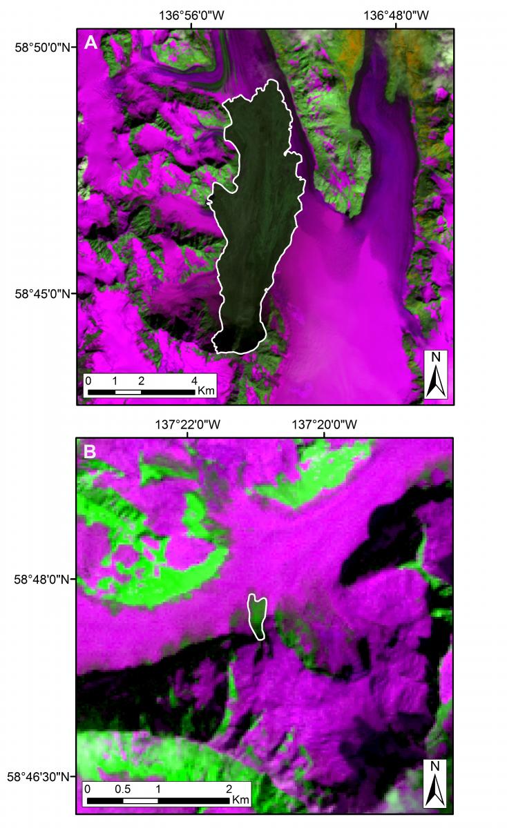
Landsat imagery (30-m resolution) was used to map and examine changes in the frequency, magnitude, and mobility of rock avalanches in GBNP between 1984 and 2016. Landsat’s shortwave infrared bands (Band 5 on Landsats 5 and 7; Band 6 on Landsat 8), which penetrate thin clouds and discriminate changes in ground moisture content, were found to most effectively differentiate between rock avalanche deposits and the surrounding glaciated terrain. In addition to the use of single band images, multi-band false-color images were used to accentuate differences between snow or ice and rock avalanche debris. Band combinations 453 (Landsat 5/7) and 564 (Landsat 8) were found to be most effective for mapping in this region. A 5-m resolution Digital Elevation Model (DEM) was used in conjunction with Landsat imagery to determine the total area covered by each rock avalanche, the maximum travel distance measured along a curvilinear centerline (L), and the maximum change in elevation between the start and end points of the centerline (H).
Three clusters of rock avalanches were identified. The first two clusters occurred between September 1984–July 1986 and June 1994–June 1995. The most recent cluster, which includes four of the five largest rock avalanches, began in June 2012 and continued through the end of the study period. Evaluation of rock avalanche characteristics showed the size and travel distance (as measured by H/L) of the recorded rock avalanches increased over the 33-year period. A slight decrease in the return period of rock avalanches was also observed. The inventory serves as a baseline for future examination of rock avalanche frequency and size from remotely sensed imagery collected over this region.
https://www.sciencebase.gov/catalog/item/57c9ad65e4b0f2f0cec1923b

False-color composite Landsat images showing the (A) largest and (B) smallest mapped rock avalanches (outlined in white) in Glacier Bay National Park, Alaska, between 1984 and 2016.

