Nearly a quarter of California’s freshwater supply flows through the Sacramento-San Joaquin Delta, an area that comprises marshland and reclaimed land in the form of islands surrounded by levees. The Delta is of critical importance to the State’s water supply, contains prime agricultural resources, and functions as a vital estuarine ecosystem. Land-surface subsidence and levee instability within the Delta pose serious threats to meeting Federal, State, and local goals related to ecosystem restoration and land, water-resource, and flood-disaster management. Unmanned Aerial Vehicle Synthetic Aperture Radar (UAVSAR) operated by the Jet Propulsion Laboratory (JPL) is an economical remote sensing tool for monitoring land-surface subsidence and levee stability throughout the vast levee network of the Sacramento-San Joaquin Delta. However, the spatial resolution of the UAVSAR interferometry has not been independently validated. The objective of the work is to provide the JPL with high-quality, spatially dense geodetic data for the validation of UAVSAR interferometry.
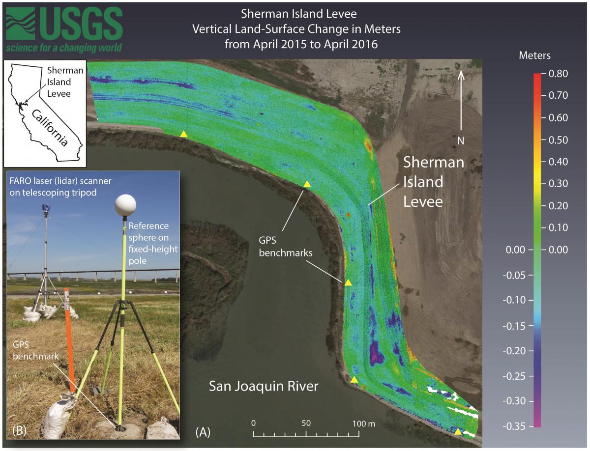
Three Terrestrial Laser Scanning (TLS) surveys of the Sherman Island levee were conducted simultaneously with UAVSAR flights between April 2015 and April 2016. The terrestrial laser scanner (lidar scanner) was elevated using a telescoping tripod to increase the areal coverage of scans and to improve the vegetation penetration with a “look down” vantage. Static GPS measurements of benchmarks in the study area were taken concurrently with the TLS surveys in order to georeference the TLS point cloud data in three dimensions.
The comparison of high-resolution, georeferenced TLS data with UAVSAR interferometry will provide the JPL with a means for evaluating the resolution and accuracy of the interferometry technique. Federal, State, and local water managers, flood disaster managers, emergency personnel, ecosystem planners, and other UAVSAR data users will have a greater understanding of the strengths and limitations of the remote sensing technique.

Sherman Island levee vertical land-surface change from April 2015 to April 2016, detected with terrestrial laser scanning surveys. (A) Difference map showing vertical land-surface change, in meters (see color scale), from April 2015 to April 2016. (B) FARO laser scanner on telescoping tripod, reference sphere on fixed-height pole, and GPS benchmark at the Sherman Island levee.

