
The BLM National Operations Center (NOC) provides remotely sensed geospatial data products to support fire management officials conducting Emergency Stabilization and Rehabilitation (ESR) activities on wildfire-affected BLM lands. The ESR program is implemented to lessen post-fire effects such as erosion and to restore affected habitats. Remote sensing products assist management officials in completing key objectives, including monitoring vegetation treatments and reforestation and rehabilitating land cover. To support 2018 ESR efforts, the NOC is providing products derived from the European Space Agency’s Sentinel-2 system to requesting officials. The products include pre- and post-event Sentinel-2 visible to shortwave-infrared (VSWIR) imagery, which have been spatially subset to the fire-affected area to reduce file storage space. Normalized Difference Vegetation Index (NDVI), Normalized Burn Ratio (NBR), Delta NDVI (dNDVI), and Delta NBR (dNBR) products are also derived and disseminated. Finally, the NOC provides a classification product identifying burned and unburned cover. These data and maps provide managers with timely information on the impact of fire in their landscapes and are accessible via download and as Web-based image and map services.
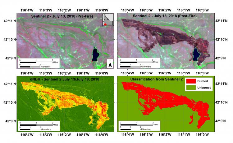
Products derived from Sentinel-2 imagery of the Otter Fire in Idaho.